The National Geologic Map Database is migrating to a new infrastructure. We apologize for any service disruptions during this process.
|
|---|


- Usage in publication:
-
- Priests Pass leucomonzonite*
- Modifications:
-
- Named
- Dominant lithology:
-
- Monzonite
- AAPG geologic province:
-
- Montana folded belt
Summary:
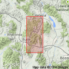
Name applied to a mass at Priests Pass south of Mullan Pass, Lewis and Clark Co, MT in the Montana folded belt province. Geologic map; shown as a small mass that straddles the Continental divide, extending into adjacent Powell Co, MT in the Montana folded belt province. No type locality designated. Chemical composition shown on a table. Is in contact with Clancy granodiorite (new), and with pre- and post-bathylithic rocks. Is one of five intrusions related to the Boulder bathylith. Late Cretaceous age.
Source: GNU records (USGS DDS-6; Denver GNULEX).
- Usage in publication:
-
- Priest Pass Leucomonzonite*
- Modifications:
-
- Overview
- AAPG geologic province:
-
- Montana folded belt
Summary:
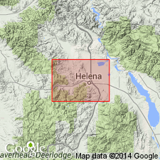
Name emended to Priest Pass Leucomonzonite. Is a rock of monzonite composition, nearly devoid of quartz, about 9 percent hornblende and biotite. Mapped in the west-central part of area in four areas in Lewis and Clark and adjacent Powell Cos, MT in the Montana folded belt province. Assigned to the Cretaceous.
Source: GNU records (USGS DDS-6; Denver GNULEX).
For more information, please contact Nancy Stamm, Geologic Names Committee Secretary.
Asterisk (*) indicates published by U.S. Geological Survey authors.
"No current usage" (†) implies that a name has been abandoned or has fallen into disuse. Former usage and, if known, replacement name given in parentheses ( ).
Slash (/) indicates name conflicts with nomenclatural guidelines (CSN, 1933; ACSN, 1961, 1970; NACSN, 1983, 2005, 2021). May be explained within brackets ([ ]).