The National Geologic Map Database is migrating to a new infrastructure. We apologize for any service disruptions during this process.
|
|---|


- Usage in publication:
-
- Prentiss Group
- Modifications:
-
- Original reference
- Dominant lithology:
-
- Sandstone
- Conglomerate
- Siltstone
- Graywacke
- Slate
- AAPG geologic province:
-
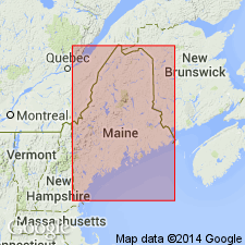
- New England province
Summary:
Prentiss Group is a sedimentary cover sequence eroded from older Miramichi rocks. Contains clasts from the Cambrian and Ordovician Baskahegan Lake and Stetson Mountain Formations. Group is subdivided into (ascending) Mill Priviledge Brook (new), Sam Rowe Ridge (new), Ellen Wood Ridge (new), and Daggett Ridge (revised) Formations. Prentiss Group was first described in two Maine Geological Survey Open-File Reports by Ludman (1988) and Hopeck (1989) [unavailable for review]. Unconformably overlies Kossuth Group (new). Possibly correlates with the Belle Lake Slate in the upper Tetagouche Group of New Brunswick, CAN, and is assigned a Late Ordovician and Silurian age.
[GNU remark (April 9, 1992, USGS DDS-6; Reston GNULEX): Though author states intent to name, information presented in this report is insufficient to consider this a formal proposal.]
Source: GNU records (USGS DDS-6; Reston GNULEX).
- Usage in publication:
-
- Prentiss Group
- Modifications:
-
- Areal extent
- AAPG geologic province:
-
- New England province
Summary:
The Prentiss Group composes the southern marginal facies of the Aroostook-Matapedia belt. The formations within the Prentiss grade into one another laterally as well as vertically. The two lower units (Mill Priviledge Brook and Sam Row Ridge Formations) interfinger with rocks that make up most of the Aroostook-Matapedia belt (Carys Mills and Smyrna Mills Formations), indicating an Ashgillian age for the lower Prentiss.
[GNU remark (August 13, 1993, USGS DDS-6; Reston GNULEX): Unit name is italicized throughout the report as authors consider it and three of its formations informal at this time. They state that it will be formally proposed but do not indicate a reference for such a proposal.]
Source: GNU records (USGS DDS-6; Reston GNULEX).
For more information, please contact Nancy Stamm, Geologic Names Committee Secretary.
Asterisk (*) indicates published by U.S. Geological Survey authors.
"No current usage" (†) implies that a name has been abandoned or has fallen into disuse. Former usage and, if known, replacement name given in parentheses ( ).
Slash (/) indicates name conflicts with nomenclatural guidelines (CSN, 1933; ACSN, 1961, 1970; NACSN, 1983, 2005, 2021). May be explained within brackets ([ ]).