The National Geologic Map Database is migrating to a new infrastructure. We apologize for any service disruptions during this process.
|
|---|


- Usage in publication:
-
- Prairie member
- Modifications:
-
- Original reference
- Dominant lithology:
-
- Sand
- Clay
- AAPG geologic province:
-
- Gulf Coast basin
Summary:
Pg. 78 (fig. 6), 163-166. Prairie member. Series of Pleistocene deposits in Grant and La Salle Parishes is divided into four members, their names corresponding to the four distinct depositional terrace surfaces, Williana (oldest), Bentley, Montgomery, and Prairie. Prairie deposits, which in many areas are identical in appearance to those of the present flood plain, border the alluvial valley of the Mississippi and occur to greater distances flanking tributary streams than any of the older flood-plain materials. A typical section consists of an alternation of silty sands and silty clays, and loamy material with some coarse sand lenses. Thickness 20 to 52 feet.
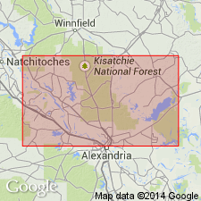
Named from Prairie Terrace typically developed near Aloha, in sec. 16, T. 7 N., R. 4 W., Grant Parish, and at Nebo School, in sec. 40, T. 7 N., R. 3 E., La Salle Parish, central LA.
Source: US geologic names lexicon (USGS Bull. 1200, p. 3376).
- Usage in publication:
-
- Prairie formation*
- Modifications:
-
- Revised
- AAPG geologic province:
-
- Gulf Coast basin
Summary:
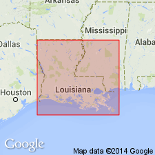
Pg. 182-183, pl. 1. Prairie formation. Rank raised to formation. Described in Rapides and Avoyelles Parishes, central Louisiana, where it consists entirely of fresh-water clays, silts, sands, and basal graveliferous deposits; all but upper 20 feet of sequence is covered by Recent alluvium. [Age is Pleistocene. Adopted by the USGS.]
Source: US geologic names lexicon (USGS Bull. 1200, p. 3125).
- Usage in publication:
-
- Prairie Formation
- Modifications:
-
- Principal reference
- Dominant lithology:
-
- Silt
- Mud
- AAPG geologic province:
-
- Gulf Coast basin
Summary:
Designates Prairie a valid, regionally correlatable and mappable lithostratigraphic unit of formation rank. Study area is Houston Ridge in Calcasieu Parish, southwest Louisiana. At type [principal reference] consists of silt and mud; thickness 20.6 feet. Upper boundary is Prairie terrace (coastwise terrace surface). Overlies Biloxi Formation; to north it overlies Montgomery unit (revised to informal unit). Age is late Pleistocene (Sangamonian).
Type section [principal reference section]: Bayou Choupique Drillhole No. 6, in SE/4 sec. 14, T. 11 S., R. 10 W., Calcasieu Parish, southwestern LA.
Source: Modified from GNU records (USGS DDS-6; Denver GNULEX).
- Usage in publication:
-
- Prairie Formation
- Modifications:
-
- Areal extent
- AAPG geologic province:
-
- Mid-Gulf Coast basin
Summary:
Unit originally named Pamlico in Florida is here redefined as the Prairie Formation of Sangamonian age. Described as a fluvial unit that commonly brackets the Biloxi Formation and directly underlies the youngest Pleistocene coastwise surface. Deposition of the Prairie continued into the early Wisconsinan. Formation is composed of granular coarse sand, fine to medium sand, and silty sand with occasional gravel and lignite-peat lenses. Surface rises landward to +9 m at the present coast and inland reaches altitudes of 20 to 35 m. Surface is continuous with the "Beaumont" surface of southeastern TX and the "Pamlico" surface in western Florida. In the subsurface, interfingers southward with the Biloxi Formation.
Source: GNU records (USGS DDS-6; Reston GNULEX).
- Usage in publication:
-
- Prairie Formation*
- Modifications:
-
- Areal extent
- AAPG geologic province:
-
- Mid-Gulf Coast basin
GNU Staff, 1995, Draft copy of Otvos, E.G., Mississippi Gulf Coast; geologic evolution, stratigraphy, coastal geomorphology, and Gulf-wide Pleistocene correlations, USGS Bull. XXXX (unpublished): U.S. Geological Survey Digital Data Series, DDS-6, 1 CD-ROM., release 3
Summary:
Pleistocene Prairie Formation occurs in MS. Interfingers with Biloxi Formation.
Source: GNU records (USGS DDS-6; Reston GNULEX).

- Usage in publication:
-
- Prairie Complex
- Modifications:
-
- Overview
- AAPG geologic province:
-
- Gulf Coast basin
Summary:
(Quaternary stratigraphic chart). Prairie Complex. An allostratigraphic unit, defined and correlated by morphologic expression. Consists of one or more alloformations which have yet to be determined. Medial part correlative with upper Pleistocene Sicily Loess and Valley Trains. Younger than Intermediate Complex (early to middle Pleistocene), older than Peoria Loess (late Pleistocene). = Beaumont Formation of Texas. Age is late Quaternary (middle to late Pleistocene).
[Btw. ca. 2000 to 2012 during detailed and reconnaissance mapping (Louisiana Geol. Survey geol. quad. maps, scales 1:24,000, 1:100,000), the Prairie is referred to as Prairie Allogroup and subdivided into informal and formal alloformations. Is older than Deweyville Allogroup; younger than informal Intermediate and Upland allogroups. Age is late Quaternary (middle to late Pleistocene).
In southwestern Louisiana (Crowley, De Ridder, Lake Charles, Port Arthur, White Lake quadrangles), includes, youngest to oldest, informal Big Cane alloformation, Avoyelles alloformation, and formal Beaumont Alloformation.
In central southern Louisiana (Baton Rouge, Morgan City quadrangles), includes, youngest to oldest, Big Cane Alloformation, Avoyelles Alloformation, and Beaumont Alloformation and its eastern equivalent Hammond Alloformation (all formal).
In southeastern Louisiana (Amite, Bogalusa, Gulfport, Ponchatoula quadrangles), includes, youngest to oldest, Bush, Hammond, and Irene alloformations (all informal).]
Source: Publication.
- Usage in publication:
-
- Prairie Allogroup
- AAPG geologic province:
-
- Gulf Coast basin
GNC Staff, 2010, [U.S. Geologic Names Committee remarks on allogroups of Louisiana]: U.S. Geological Survey, unpublished Geologic Names Committee note
Summary:
Prairie Allogroup. Age is late Quaternary (Pleistocene). Mapped on several 30' x 60' quadrangles by the Louisiana Geol. Survey.
Southwestern Louisiana:
Port Arthur (2005): includes Beaumont Alloformation; older than Mermentau Alloformation.
Lake Charles (2002): includes Beaumont Alloformation; younger than Intermediate allogroup, older than Deweyville Allogroup.
De Ridder (2002): includes Beaumont Alloformation; younger than Intermediate allogroup, older than Deweyville Allogroup.
Ville Platte (2002): includes, youngest to oldest, Big Cane alloformation, Avoyelles alloformation, Beaumont Alloformation; younger than Intermediate allogroup, older than Deweyville Allogroup.
Crowley (2003): includes, youngest to oldest, Big Cane alloformation, Avoyelles alloformation, Beaumont Alloformation; younger than Intermediate allogroup, older than Deweyville Allogroup.
White Lake (2006): includes Avoyelles alloformation, Beaumont Alloformation; older than Peoria Loess.
Central southern Louisiana:
Baton Rouge (2000): includes, youngest to oldest, Big Cane Alloformation, Avoyelles Alloformation, Beaumont Alloformation, Hammond Alloformation; older than Peoria Loess.
Morgan City (2012): includes Avoyelles alloformation; older than Peoria Loess.
Southeastern Louisiana:
Ponchatoula (2003): includes Hammond alloformation; older than Peoria Loess.
Amite (2009): includes, youngest to oldest, Hammond alloformation, Irene alloformation; younger than Intermediate allogroup, older than Deweyville Allogroup.
Bogalusa (2007): includes, youngest to oldest, Bush alloformation, Hammond alloformation; younger than Intermediate allogroup, older than Deweyville Allogroup.
Gulfport (2004): includes Hammond alloformation; older than Deweyville Allogroup, younger than Pliocene Citronelle Formation in Upland allogroup.
Source: N.R. Stamm, compiler, US geologic names lexicon, Geolex.
For more information, please contact Nancy Stamm, Geologic Names Committee Secretary.
Asterisk (*) indicates published by U.S. Geological Survey authors.
"No current usage" (†) implies that a name has been abandoned or has fallen into disuse. Former usage and, if known, replacement name given in parentheses ( ).
Slash (/) indicates name conflicts with nomenclatural guidelines (CSN, 1933; ACSN, 1961, 1970; NACSN, 1983, 2005, 2021). May be explained within brackets ([ ]).