

- Usage in publication:
-
- Prairie Canyon Member
- Modifications:
-
- Original reference
- Dominant lithology:
-
- Sandstone
- Dolomite
- Shale
- AAPG geologic province:
-
- Piceance Creek basin
- Uinta basin
Summary:
Prairie Canyon Member of Mancos Shale. Replaces informal "Mancos B" interval of Cole and Young, 1991 (SEPM Concepts in Sedimentology and Paleontology, v. 3, p. 277-287). Poorly exposed, but mappable, along base of the Book Cliffs from Grand Junction, Colorado, to near Woodside, Utah. Divided into (ascending): (1) a lower interval of mostly interbedded sandstone and shale, 359.5 feet (109.6 m) thick, includes basal(?) Campanian "Pinto Wash erosional surface"; (2) a middle interval of four coarsening upward sequences (shale to fine-grained sandstone) separated by transgressive-marine flooding surfaces, 233 feet (71 m) thick; and (3) an upper interval of mostly sandy dolomite, 413 feet (126 m) thick. Total thickness averages about 1,000 feet (300 m). Intertongues with Blue Gate Limestone Member of Mancos Shale. Age is Late Cretaceous. [Authors tentatively assign a latest Santonian through early late Campanian age, DESMOSCAPHITES BASSLERI through BACULITES sp. (weak flank ribs) ammonoid zones, based on regional stratigraphic relations and published biostratigraphic data.]
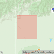
Type area: 23 mi (37 km) northwest of Grand Junction, CO, in West Salt Creek, Prairie Canyon, and Badger Wash drainages, westernmost corner Mesa Co., CO. Western edge approx. 1 mi east of Grand Co., UT - Mesa Co., CO border. Northern edge approx. 0.25 mi south of Garfield Co.,CO - Mesa Co., CO border. Much of type area overlaps Bar X gas field. [Named from Prairie Canyon].
Type section is composite of 10 measured sections within type area:
lower interval: section 8, in NE/4 sec. 7, T. 9 S., R. 103 W., and section 9, in NE/4 sec. 3, T. 9 S., R. 103 W.;
middle interval in T. 8 S., R. 104 W. (sections 1 to 7): (1) S/2 NW/4 SE/4 sec. 30, (2) center E/2 SW/4 sec. 29, (3) center W/2 SE/4 SE/4 sec. 29, (4) center S/2 NW/4 sec. 28, (5) SW/4 NE/4 sec. 28, (6) near east edge sec. 21, and (7) from SE/4 sec. 22 to NE/4 sec. 27;
upper interval: section 10, from NW corner sec. 29, through W/2 sec. 20, to center SW/4 sec. 17, T. 8 S., R. 104 W.
Reference section (subsurface): Tenneco Brunel "E" 28-10 well, approx. 18 mi (29 km) north-northeast of type area, in NW/4 SE/4 sec. 28, T. 4 S., R. 102 W., Rio Blanco Co., CO.
Source: Publication.
For more information, please contact Nancy Stamm, Geologic Names Committee Secretary.
Asterisk (*) indicates published by U.S. Geological Survey authors.
"No current usage" (†) implies that a name has been abandoned or has fallen into disuse. Former usage and, if known, replacement name given in parentheses ( ).
Slash (/) indicates name conflicts with nomenclatural guidelines (CSN, 1933; ACSN, 1961, 1970; NACSN, 1983, 2005, 2021). May be explained within brackets ([ ]).