- Usage in publication:
-
- Powers Ferry Formation*
- Modifications:
-
- Named
- Dominant lithology:
-
- Gneiss
- Schist
- Amphibolite
- AAPG geologic province:
-
- Piedmont-Blue Ridge province
Summary:
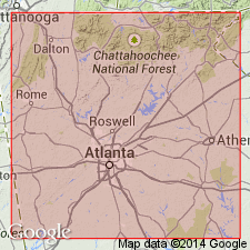
Named for Powers Ferry (now called Powers Ferry Landing) on the Chattahoochee River, GA, where rocks are well exposed in the Powers Ferry Landing shopping center and office park area. Includes the Mableton Amphibolite Member. Includes rocks mapped as gneiss-schist-amphibolite in Higgins (1966, 1968). Consists of intercalated gneiss, schist, and amphibolite in decreasing order of abundance. Gneiss is medium-grained, gray, discontinuously striped muscovite-biotite-microcline-quartz-oligoclase gneiss with local pink microcline augen. Also contains some epidote, opaque minerals, and garnet. Concordant quartz-microcline pegmatite is fairly common. Pods and discontinuous layers of muscovite-biotite-quartz schist, amphibolite, and hornblende schist are common and locally constitute the entire formation. Parts of the gneiss resemble massive quartzite. Base of formation not seen. Upper contact with overlying Chattahoochee Palisades Quartzite is sharp and possibly unconformable. Actual thickness is unknown but is estimated to be more than 1,000 m (3,290 ft) thick on the basis of mapping. Age is late Precambrian and (or) early Paleozoic.
Source: GNU records (USGS DDS-6; Reston GNULEX).

- Usage in publication:
-
- Powers Ferry Formation*
- Modifications:
-
- Revised
- Age modified
- AAPG geologic province:
-
- Piedmont-Blue Ridge province
Summary:
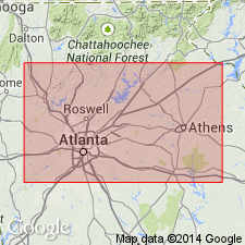
Rocks mapped as Norris Lake Schist Member of the Snellville Formation southeast of the Brevard zone, Dog River Formation southeast of Villa Rica, part of the Tallulah Falls Formation, part of the Pumpkinvine Creek Formation, and part of the Univeter Formation, are now shown to belong to the Powers Ferry Formation of the Sandy Springs Group in the Sandy Springs thrust sheet in GA and AL. The Tallulah Falls Formation is geographically restricted from this area and the other units are abandoned. Age is Late Proterozoic to Early Ordovician(?).
Source: GNU records (USGS DDS-6; Reston GNULEX).

- Usage in publication:
-
- Powers Ferry Member*
- Modifications:
-
- Revised
- Age modified
- AAPG geologic province:
-
- Piedmont-Blue Ridge province
Summary:
Detailed mapping during 1990-1993 has shown that 1) Sandy Springs Group is a sequence of fault slices that mimics true stratigraphy and 2) Powers Ferry Formation is actually a facies of Stonewall Gneiss (name revised from Stonewall Formation) and is in fault contact with the rest of Sandy Springs Group. Powers Ferry is here removed from Sandy Springs Group and reassigned as Powers Ferry Member of Stonewall Gneiss in allochthonous assemblage. Detailed mapping has also shown that rocks previously mapped as Mableton Amphibolite Member of Powers Ferry Formation are actually part of Ropes Creek Metabasalt; therefore, the name Mableton Amphibolite Member is herein abandoned. Age of Powers Ferry and Stonewall is changed to Late Proterozoic(?) to Middle Ordovician(?) based on a more conservative theory that the allochthonous rocks are 1) probably not older than Late Proterozoic because they are not part of Middle Proterozoic (Grenvillian) basement and 2) they could be as young, but not younger than, the time marking the beginning of closure of the ocean they originated in, as set by the slope reversal marked by deposition of Middle Ordovician Rockmart Slate upon unconformity at top of Upper Cambrian to Middle(?) Ordovician Knox Group and Middle Ordovician Lenoir Limestone. Report includes geologic map and correlation chart.
Source: GNU records (USGS DDS-6; Reston GNULEX).
For more information, please contact Nancy Stamm, Geologic Names Committee Secretary.
Asterisk (*) indicates published by U.S. Geological Survey authors.
"No current usage" (†) implies that a name has been abandoned or has fallen into disuse. Former usage and, if known, replacement name given in parentheses ( ).
Slash (/) indicates name conflicts with nomenclatural guidelines (CSN, 1933; ACSN, 1961, 1970; NACSN, 1983, 2005, 2021). May be explained within brackets ([ ]).

