The National Geologic Map Database is migrating to a new infrastructure. We apologize for any service disruptions during this process.
|
|---|


- Usage in publication:
-
- Poul Creek formation
- Modifications:
-
- Original reference
- Biostratigraphic dating
- Dominant lithology:
-
- Shale
- Sandstone
- Conglomerate
- AAPG geologic province:
-
- Alaska Southern region
Summary:
Pg. 753+. Poul Creek formation. Dark hard platy blue-gray shales (in part calcareous and in part sandy), thin-bedded sandstones, conglomerates (of stream, beach, and glacial origin), occasional thin argillaceous, blue-gray limestones, and a few beds of glauconitic sandstone. The shales greatly predominate, especially in lower part, and make up fully 75 percent of formation. Glauconitic sandstones are also present, but not so numerous as in the conformably overlying Yakataga formation; they are usually thin, but one with thickness of 25 feet was noted. Thickness 3,000+ feet; [base not exposed]. A fairly large fauna was obtained from various parts of both Yakataga and Poul Creek formations. According to B.L. Clark both are of upper Oligocene age, and = Blakeley horizon of Washington and San Ramon horizon of California.
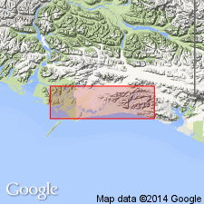
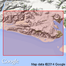
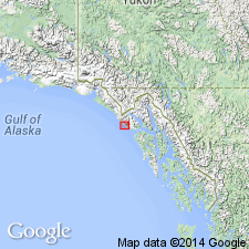
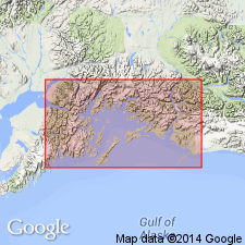
Named from exposures along Poul Creek, Yakataga district, Controller Bay region, southeastern AK. [Occurs in region eastward from Yakataga Reef to western shore of Icy Bay and from coast northward to about latitude of White River Glacier.]
Source: US geologic names lexicon (USGS Bull. 896, p. 1722); supplemental information from GNU records (USGS DDS-6; Menlo GNULEX).
- Usage in publication:
-
- Poul Creek formation*
- Modifications:
-
- Principal reference
- Revised
- Age modified
- Biostratigraphic dating
- Adopted
- AAPG geologic province:
-
- Alaska Southern region
Summary:
Poul Creek formation. Redefined to consist of approximately 6,100 feet of marine interbedded siltstone and sandstone strata that lie with apparent conformity on Kulthieth formation. As defined, formation includes in upper part most of the strata originally assigned to it at type locality on Poul Creek; also includes lower part of Yakataga Reef section, which was originally assigned to overlying Yakataga formatlon, and excludes beds described by Taliaferro as "glacio-fluvial conglomerates," here assigned to Yakataga formation. Age given in text as late Oligocene and early Miocene based on paleontologic evidence; mapped as Oligocene and Miocene.
Type locality: On Poul Creek, Yakataga district, Controller Bay region, southeastern AK.
Source: US geologic names lexicon (USGS Bull. 1200, p. 3120).
- Usage in publication:
-
- Poul Creek Formation*
- Modifications:
-
- Age modified
- Biostratigraphic dating
- AAPG geologic province:
-
- Alaska Southern region
Summary:
Age of unit is late Eocene, Oligocene, and early Miocene based on molluscan fauna (Allison, 1976, 1977).
Source: GNU records (USGS DDS-6; Menlo GNULEX).
- Usage in publication:
-
- Poul Creek Formation*
- Modifications:
-
- Revised
- Biostratigraphic dating
- AAPG geologic province:
-
- Alaska Southern region
Summary:
Unit extended into Chugach National Forest at expense of Katalla Formation (thereby abandoning Katalla) owing to equivalent age and lithology. In Don Miller Hills, former members of Katalla which are reassigned to Poul Creek Formation include (ascending): Split Creek Sandstone, Basin Creek, and Burls Creek Shale Members. Conformably overlies Tokun Formation; conformably underlies Redwood Formation in Chugach area. Mollusks from unit indicate range in age from late Eocene (Galvinian or "Keasey") through much of Oligocene (Matlockian or "Blakeley") (Addicott and others, 1978). Foraminifers from same localities indicate range in age from late late Eocene through early Miocene (Refugian, Zemorrian, and Saucesian Stages) (Rau and others, 1977).
Source: GNU records (USGS DDS-6; Menlo GNULEX).
For more information, please contact Nancy Stamm, Geologic Names Committee Secretary.
Asterisk (*) indicates published by U.S. Geological Survey authors.
"No current usage" (†) implies that a name has been abandoned or has fallen into disuse. Former usage and, if known, replacement name given in parentheses ( ).
Slash (/) indicates name conflicts with nomenclatural guidelines (CSN, 1933; ACSN, 1961, 1970; NACSN, 1983, 2005, 2021). May be explained within brackets ([ ]).