The National Geologic Map Database is migrating to a new infrastructure. We apologize for any service disruptions during this process.
|
|---|


- Usage in publication:
-
- Poughquag Quartzite
- Modifications:
-
- Revised
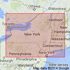
- AAPG geologic province:
-
- Appalachian basin
Summary:
Poughquag is shown as basal formation of Wappinger Group, conformably underlying Stissing Dolomite and nonconformably overlying Precambrian basement. The Wappinger is assigned to the Sauk Sequence in this report. Age is Early Cambrian.
Source: GNU records (USGS DDS-6; Reston GNULEX).
For more information, please contact Nancy Stamm, Geologic Names Committee Secretary.
Asterisk (*) indicates published by U.S. Geological Survey authors.
"No current usage" (†) implies that a name has been abandoned or has fallen into disuse. Former usage and, if known, replacement name given in parentheses ( ).
Slash (/) indicates name conflicts with nomenclatural guidelines (CSN, 1933; ACSN, 1961, 1970; NACSN, 1983, 2005, 2021). May be explained within brackets ([ ]).