The National Geologic Map Database is migrating to a new infrastructure. We apologize for any service disruptions during this process.
|
|---|


- Usage in publication:
-
- Porvenir Formation*
- Modifications:
-
- Original reference
- Dominant lithology:
-
- Shale
- Limestone
- AAPG geologic province:
-
- Palo Duro basin
- Las Vegas-Raton basin
Summary:
Porvenir Formation of Madera Group. Rocks previously called the lower gray limestone member of the Madera Formation are here named the Porvenir Formation, the lower unit of the Madera Group in the southeastern Sangre de Cristo Mountains, San Miguel and Mora Counties, New Mexico. Includes three laterally intergrading marine facies: a southern carbonate facies, a shale-carbonate facies, and a northern sandstone-shale-carbonate facies. Consists of limestone and interbedded gray shale and a minor amount of sandstone at the type section, characteristic of the southern carbonate facies deposited in shallow seas. Consists of shale, sandy and oolitic limestones, and arkosic sandstone to the northeast. Conformably overlies the Sandia Formation; disconformably underlies the Alamitos Formation of the Madera Group. Thickness at the type section is 1,065 feet and ranges from 700 to 1,615 feet. Age is Middle Pennsylvanian based on fusulinids of Desmoinesian age.
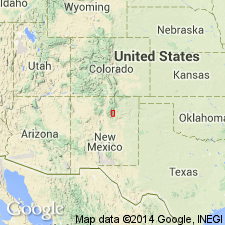
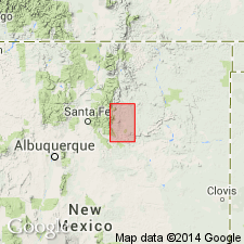
Type section: along U.S. Forest Service Johnson Mesa Road on ridge south of Canovas Canyon, a tributary of Gallinas Creek, about 12.5 mi northwest of Las Vegas, near center sec. 23, T. 17 N., R. 14 E., San Miguel Co., NM, Las Vegas-Raton basin. Named from exposures in hogbacks near El Porvenir Campground.
Principal reference locality (a composite of measured sections): from near San Isidro Cemetery, along Highway 94, across Canondel Horno and west along ridge south of that canyon, San Miguel Co., NM.
Recognized from south of Gallinas Creek, San Miguel Co., to Mora, Mora Co.
Source: US geologic names lexicon (USGS Bull. 1565, p. 256); supplemental information from GNU records (USGS DDS-6; Denver GNULEX).
- Usage in publication:
-
- Porvenir Formation*
- Modifications:
-
- Reference
- Dominant lithology:
-
- Shale
- Sandstone
- Limestone
- AAPG geologic province:
-
- Las Vegas-Raton basin
- Palo Duro basin
Summary:
Mapped in southeastern Sangre de Cristo Mountains, Mora and San Miguel Cos, NM, Las Vegas-Raton and Palo Duro basins. Lower of two formations of Madera Group. Absent due to erosion in southeastern part of area south of Ojitos Frios and southwest of Agua Zarca. Occurs in subsurface of Las Vegas basin. Consists of three laterally intergrading facies: southern, mainly carbonate facies; northern, sandstone-shale-limestone facies; and northwestern, mainly shaly facies. Measured sections; detailed description of type (section D) and geologic map of type (figure 81); reference section (section K, fig. 89) measured short distance north of Highway 3 northwest and northeast of St. Joseph Church, Mora Co. At reference, Porvenir consists of 680 ft of shale, limestone and sandstone. Nomenclature chart. Equivalent to upper carbonate part of La Pasada Formation; generally age equivalent to Los Moyos Limestone in Manzano Mountains, though uppermost part of Los Moyos is slightly younger. Isopach map; thickens generally northward; thickness is 500-800 ft in southwest to maximum of 1,614 ft east of Rociada. Megafossils and fusulinids list (plate 5). Conformably overlies Sandia Formation (contact near Atokan-Desmoinesian boundary); underlies Alamitos, locally unconformably. Middle Pennsylvanian (early to late Desmoinesian) age based on fusulinids (BEEDEINA zone; zonation shown on fig. 54).
Source: GNU records (USGS DDS-6; Denver GNULEX).
- Usage in publication:
-
- Porvenir Formation
- Modifications:
-
- Revised
- AAPG geologic province:
-
- Las Vegas-Raton basin
- Palo Duro basin
Kues, B.S., 2001, The Pennsylvanian System in New Mexico; Overview with suggestions for revisions of stratigraphic nomenclature: New Mexico Bureau of Geology and Mineral Resources, New Mexico Geology, v. 23, no. 4, p. 103-122.
Summary:
Pg. 109. Porvenir Formation. Excluded from Madera Group. Consists of dominantly clastic facies and differs so greatly from typical lower Madera lithologies (=uniform, massive, cherty limestones) that application of term Madera Group is not recommended.
Source: Publication.
For more information, please contact Nancy Stamm, Geologic Names Committee Secretary.
Asterisk (*) indicates published by U.S. Geological Survey authors.
"No current usage" (†) implies that a name has been abandoned or has fallen into disuse. Former usage and, if known, replacement name given in parentheses ( ).
Slash (/) indicates name conflicts with nomenclatural guidelines (CSN, 1933; ACSN, 1961, 1970; NACSN, 1983, 2005, 2021). May be explained within brackets ([ ]).