

- Usage in publication:
-
- Porter's Creek group
- Modifications:
-
- Named
- Dominant lithology:
-
- Clay
- AAPG geologic province:
-
- Upper Mississippi embayment
Summary:
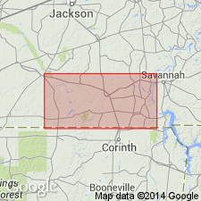
Porter's Creek group named for exposures on Porters Creek, Hardeman Co., TN. No marked distinction between this and adjacent groups (Ripley and LaGrange), except that it contains proportionally much more laminated or slaty clay, several beds of which are from 5 to 60 ft thick. On Porter's Creek, west of Middleton, is a heavy bed said to be 100 ft thick. The clay has the usual characteristics, contains mica scales, is dark when wet and whitish gray when dry. Thickness averages between 200 and 300 ft. Underlies Orange sand or LaGrange group and overlies Ripley group (Cretaceous). Previously included in Orange sand.
Source: GNU records (USGS DDS-6; Reston GNULEX).
- Usage in publication:
-
- Porters Creek clay
- Modifications:
-
- Revised
- Age modified
- AAPG geologic province:
-
- Upper Mississippi embayment
Harris, G.D., 1896, The Midway stage: Bulletins of American Paleontology, v. 1, no. 4, 157 p.
Summary:
Pg. 18-22. Porters Creek clay of Midway group. Established the Midway age of Porters Creek clay and †Middleton formation (Clayton formation), and Midway group is now used to include Porters Creek clay above and Clayton formation below. [Age is early Eocene.]
Source: US geologic names lexicon (USGS Bull. 896, p. 1706-1707).
- Usage in publication:
-
- Porters Creek clay*
- Modifications:
-
- Revised
- Areal extent
- AAPG geologic province:
-
- Upper Mississippi embayment
- Black Warrior basin
Summary:
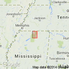
In addition to typical clay facies, the Porters Creek includes Tippah sand lentil in lower part, in northern part of Tippah Co., MS, and Matthews Landing marl member at top, from Winston Co., MS, to Butler Co., AL. At outcrop in northern MS, the Porters Creek is about 200 ft thick, but thickens southward in subsurface to about 600 ft. Typical clay facies extends from southern IL and southeastern MO to Tombigbee River in western AL. Underlies Naheola formation; overlies Chalybeate member (new) of Clayton Formation. Assigned to Midway Group of Paleocene age. Name Sucarnooche clay, formerly used for entire Porters Creek in AL as well as for the calcareous clay east of Tombigbee River, has been abandoned.
Source: GNU records (USGS DDS-6; Reston GNULEX).
- Usage in publication:
-
- Porters Creek clay*
- Modifications:
-
- Overview
- AAPG geologic province:
-
- Mid-Gulf Coast basin
Summary:
Unit described in Choctaw Co., AL, where it is about 350 ft thick and represents lowermost deposits of Midway group exposed in county. Includes Chalybeate limestone member (at base) and Matthews Landing marl member at top. Underlies Naheola formation. [Chalybeate was abandoned by the GNC according to the minutes of the 5/11/61 meeting.]
Source: GNU records (USGS DDS-6; Reston GNULEX).
- Usage in publication:
-
- Porters Creek clay
- Modifications:
-
- Overview
- AAPG geologic province:
-
- Upper Mississippi embayment
Summary:
Porters Creek is oldest outcropping formation in Benton Co., MS. Only upper 70 to 80 ft exposed. Underlies Betheden formation.
Source: GNU records (USGS DDS-6; Reston GNULEX).
- Usage in publication:
-
- Porters Creek clay
- Modifications:
-
- Overview
- AAPG geologic province:
-
- Black Warrior basin
Summary:
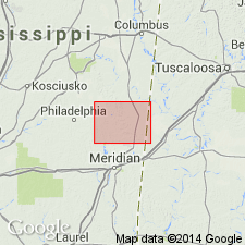
Porters Creek clay of Midway group is approximately 500 ft thick in Kemper Co., MS. Consists of the typical clay facies, somewhat sandy and laminated at top. Includes Matthews Landing marl member at top. Conformably overlies Clayton formation (Chalybeate member at top); unconformably underlies Naheola formation.
Source: GNU records (USGS DDS-6; Reston GNULEX).
- Usage in publication:
-
- Porters Creek Clay*
- Modifications:
-
- Areal extent
- AAPG geologic province:
-
- Arkla basin
Summary:
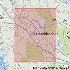
Porters Creek Clay extended to Natchitoches Parish, central LA.
Source: GNU records (USGS DDS-6; Reston GNULEX).
- Usage in publication:
-
- Porters Creek Clay*
- Modifications:
-
- Areal extent
- AAPG geologic province:
-
- Arkla basin
Summary:
Porters Creek Clay extended to southern Arkansas in this report.
Source: GNU records (USGS DDS-6; Reston GNULEX).
- Usage in publication:
-
- Porters Creek Formation*
- Modifications:
-
- Areal extent
- AAPG geologic province:
-
- South Georgia sedimentary province
Summary:
Porters Creek Formation is geographically extended from AL into westernmost GA. Overlies Clayton Formation; underlies Nanafalia Formation. Age is Paleocene.
Source: GNU records (USGS DDS-6; Reston GNULEX).

- Usage in publication:
-
- Porters Creek Formation
- Modifications:
-
- Overview
- AAPG geologic province:
-
- Mid-Gulf Coast basin
Summary:
Porters Creek Formation is middle of three units in Midway Group in western and south-central AL. East of Crenshaw Co., equivalent facies are included in the Clayton Formation. Thickness ranges from 450 ft in western part of Coastal Plain to 150 ft in Wilcox and Butler Cos. Includes Matthews Landing Marl Member (at top). Age is Paleocene (Midway, Danian-Thanetian).
Source: GNU records (USGS DDS-6; Reston GNULEX).
- Usage in publication:
-
- Porters Creek Clay*
- Modifications:
-
- Biostratigraphic dating
- AAPG geologic province:
-
- Mid-Gulf Coast basin
Summary:
Porters Creek Clay shown as Paleocene (Midway) age on fig. 1. Midway age based on CRASSATELLA AQUIANA and CRASSATELLA TUMIDULA collected from Wilcox Co., central AL.
Source: GNU records (USGS DDS-6; Reston GNULEX).
For more information, please contact Nancy Stamm, Geologic Names Committee Secretary.
Asterisk (*) indicates published by U.S. Geological Survey authors.
"No current usage" (†) implies that a name has been abandoned or has fallen into disuse. Former usage and, if known, replacement name given in parentheses ( ).
Slash (/) indicates name conflicts with nomenclatural guidelines (CSN, 1933; ACSN, 1961, 1970; NACSN, 1983, 2005, 2021). May be explained within brackets ([ ]).