- Usage in publication:
-
- Portage Brook Member*
- Modifications:
-
- Named
- Dominant lithology:
-
- Phyllite
- Slate
- Quartzite
- AAPG geologic province:
-
- New England province
Summary:
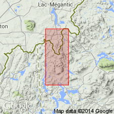
Named as a member of the Albee Formation for Portage Brook, Cupsuptic 15-min quad, west-central ME. Type area is exposures between Portage Brook and Lincoln Pond. Other exposures on lower east slope of Deer Mountain and on east-trending ridge of Deer Mountain. 40 to 90 percent of the member consists of dark-green to light-yellowish-green phyllite and slate that weathers chalky white or light gray. Rest of member is composed of feldspathic quartzite (dark-green, paper-thin, micaceous laminae separated by lighter gray or green, quartz-feldspar-rich bands ranging in thickness from a few mm to about 3 cm), and greenish-gray and green, hard, vitreous-weathering quartzite that forms beds in the phyllite and slate. Thickness is approx. 6,000 ft. Gradational contact with underlying Aziscohos Formation or in places conformable and sharply gradational with underlying Kennebago Member of the Albee. Report includes geologic map. Age is Early and Middle Ordovician.
Source: GNU records (USGS DDS-6; Reston GNULEX).
For more information, please contact Nancy Stamm, Geologic Names Committee Secretary.
Asterisk (*) indicates published by U.S. Geological Survey authors.
"No current usage" (†) implies that a name has been abandoned or has fallen into disuse. Former usage and, if known, replacement name given in parentheses ( ).
Slash (/) indicates name conflicts with nomenclatural guidelines (CSN, 1933; ACSN, 1961, 1970; NACSN, 1983, 2005, 2021). May be explained within brackets ([ ]).

