- Usage in publication:
-
- Port Deposit granite gneiss
- Modifications:
-
- Named
- Dominant lithology:
-
- Gneiss
- Granite
- AAPG geologic province:
-
- Piedmont-Blue Ridge province
Summary:
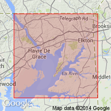
Name Port Deposit granite gneiss applied to rocks of igneous origin occurring at Port Deposit in Cecil Co., northeastern MD. Previously referred to as syenite, granite, and gneiss.
Source: GNU records (USGS DDS-6; Reston GNULEX).
- Usage in publication:
-
- Port Deposit granite (granodiorite)*
- Modifications:
-
- Age modified
- Overview
- AAPG geologic province:
-
- Piedmont-Blue Ridge province
Summary:
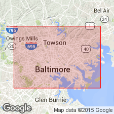
There are several outcrops of rock in Baltimore Co., MD, that have been correlated with Port Deposit gneiss of Cecil and Harford Cos., based on general geologic relations and lithologic similarity. Northeast of Baltimore the rock is gray porphyritic gneiss. The rock of Melvale area and Rognel Heights quarry is a porphyritic biotite gneiss and the granite at Oakland is a potassic muscovite granite. Port Deposit is assigned to the late Precambrian. Intrudes Glenarm series.
Source: GNU records (USGS DDS-6; Reston GNULEX).
- Usage in publication:
-
- Port Deposit granite
- Modifications:
-
- Age modified
- AAPG geologic province:
-
- Piedmont-Blue Ridge province
Summary:
Port Deposit granite and Baltimore gabbro are intrusive into Glenarm series. Port Deposit and its associates, and Baltimore gabbro are not Precambrian, but Paleozoic (post-Conestoga).
Source: GNU records (USGS DDS-6; Reston GNULEX).

- Usage in publication:
-
- Port Deposit granodiorite, complex
- Modifications:
-
- Revised
- Age modified
- AAPG geologic province:
-
- Piedmont-Blue Ridge province
Summary:
The Port Deposit granodiorite complex of this report includes, in addition to the Port Deposit granodiorite, hornblende granodiorite, hornblende granodiorite with quartz diorite pegmatite and aplite dikes, granite porphyry, and hornblende lamprophyre dikes. Age is post-Early Ordovician.
Source: GNU records (USGS DDS-6; Reston GNULEX).

- Usage in publication:
-
- Port Deposit granodiorite complex
- Modifications:
-
- Areal extent
- Overview
- AAPG geologic province:
-
- Piedmont-Blue Ridge province
Summary:
Port Deposit granodiorite is part of an Appalachian Piedmont complex in northeastern MD and northwestern DE. The Piedmont in these states, as elsewhere, is composed of metamorphosed sedimentary formations and intrusive igneous materials. In MD and PA, metamorphism in this belt increases from northwest to southeast. Most of the igneous rocks are found in southeastern part, and of these the Port Deposit granodiorite complex is the largest. It is composed of three large and several small rock bodies, separated by schists, and extends over an area about 30 mi long and 9 mi wide. Gabbro makes up parts of the north, west, and south boundaries of the complex. Rest of north boundary is composed of schists, probably of Glenarm series, and serpentine. A belt of metamorphic sedimentary rocks occurs north of the gabbro and south of the Paleozoic rocks. It is interrupted by a narrow, northeast-striking syncline of slate and conglomerates just north of Peach Bottom. Rest of south boundary is marked by overlap of unconsolidated Coastal Plain sediments and "Baltimore gneiss."
Source: GNU records (USGS DDS-6; Reston GNULEX).
- Usage in publication:
-
- Port Deposit Gneiss
- Modifications:
-
- Areal extent
- AAPG geologic province:
-
- Piedmont-Blue Ridge province
Summary:
Port Deposit Gneiss is restricted to area of its type locality near Port Deposit, MD, and extending an unknown distance along strike into Harford Co., MD. Age is changed to Late Cambrian to Late Ordovician. Age previously reported as Paleozoic(?). Unit is approximately the same age as the James Run Formation into which it grades.
Source: GNU records (USGS DDS-6; Reston GNULEX).
- Usage in publication:
-
- Port Deposit Gneiss
- Modifications:
-
- Areal extent
- AAPG geologic province:
-
- Piedmont-Blue Ridge province
Summary:
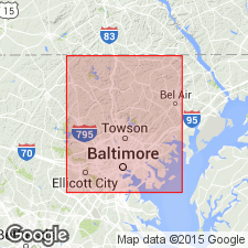
Name Port Deposit not used in area of report. Author states that extension of this name to Baltimore is unwarranted. Rocks previously mapped as Port Deposit by Southwick (1969) are here allocated to Franklinville Gneiss (new). Felsic rocks not continuous with the Franklinville, but mapped as Port Deposit by Knopf and Jonas (1925) are here named the Perry Hall Gneiss.
Source: GNU records (USGS DDS-6; Reston GNULEX).
For more information, please contact Nancy Stamm, Geologic Names Committee Secretary.
Asterisk (*) indicates published by U.S. Geological Survey authors.
"No current usage" (†) implies that a name has been abandoned or has fallen into disuse. Former usage and, if known, replacement name given in parentheses ( ).
Slash (/) indicates name conflicts with nomenclatural guidelines (CSN, 1933; ACSN, 1961, 1970; NACSN, 1983, 2005, 2021). May be explained within brackets ([ ]).

