The National Geologic Map Database is migrating to a new infrastructure. We apologize for any service disruptions during this process.
|
|---|


- Usage in publication:
-
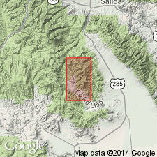
- Porphyry Peak latite*
- Modifications:
-
- Named
- Dominant lithology:
-
- Rhyolite
- Tuff
- AAPG geologic province:
-
- San Luis basin
Summary:
Named from exposures on Porphyry Peak, Saguache Co, CO in the San Luis basin. Found only in the southwest part of the Bonanza district. Consists of complex series of rhyolite flows and interbedded tuffs and perhaps some intrusive rhyolite. Total thickness unknown, but at least 1,000 ft thick. Overlies Squirrel Gulch latite; underlies Brewer Creek latite. Mapped (geologic map) in northwest part of district. Is of Tertiary age.
Source: GNU records (USGS DDS-6; Denver GNULEX).
For more information, please contact Nancy Stamm, Geologic Names Committee Secretary.
Asterisk (*) indicates published by U.S. Geological Survey authors.
"No current usage" (†) implies that a name has been abandoned or has fallen into disuse. Former usage and, if known, replacement name given in parentheses ( ).
Slash (/) indicates name conflicts with nomenclatural guidelines (CSN, 1933; ACSN, 1961, 1970; NACSN, 1983, 2005, 2021). May be explained within brackets ([ ]).