- Usage in publication:
-
- Poplar River Formation
- Modifications:
-
- Original reference
- Dominant lithology:
-
- Sand
- AAPG geologic province:
-
- Sioux uplift
- Williston basin
Summary:
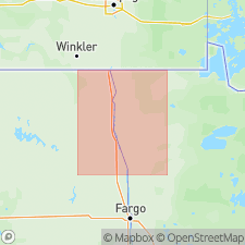
Pg. 5 (fig. 2), 7 (fig. 3), 23-25, 36-37 (measured sections). Poplar River Formation. Cross-bedded, fine- to coarse-grained sand. Near edges of Red River valley, basal part contains minor amounts of flat-bedded gravel. Thickness generally a few feet to a few tens of feet; is 100+ feet in Fargo area. Gradationally underlies, and to south is interbedded with, Sherack Formation (new); contact placed where sand ceases to be a significant constituent and clay beds are abundant. Unconformably overlies Brenna Formation (new). Occurs as linear, trough-shaped bodies throughout the Red River valley [in Cass, Traill, Grand Forks, Walsh, and Pembina Counties, North Dakota, and Clay, Norman, Polk, Red Lake, Marshall, and Kittson Counties, Minnesota]. Deposits interpreted as fluvial channel sediment with some near-channel overbank sediment. Fossils (mollusks, wood); a conifer log collected from basal part of formation yielded a radiocarbon age of 9,890+/- 150 yr B.P. Age is considered latest Wisconsinan, deposited between 11,000 and 9,900 yr B.P., during a low-water phase of glacial Lake Agassiz.
Type section: Snake Curve South section, right bank of Red Lake River, Red Lake Falls area, in SW/4 NW/4 SW/4 sec. 18, T. 151 N., R. 44 W., Red Lake Falls 15-min quadrangle, Red Lake Co., northwestern MN.
Named from Poplar River, Brooks Lake 7.5-min quadrangle, Red Lake Co., northwestern MN.
Source: Publication.
For more information, please contact Nancy Stamm, Geologic Names Committee Secretary.
Asterisk (*) indicates published by U.S. Geological Survey authors.
"No current usage" (†) implies that a name has been abandoned or has fallen into disuse. Former usage and, if known, replacement name given in parentheses ( ).
Slash (/) indicates name conflicts with nomenclatural guidelines (CSN, 1933; ACSN, 1961, 1970; NACSN, 1983, 2005, 2021). May be explained within brackets ([ ]).

