

- Usage in publication:
-
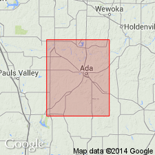
- Pontotoc terrane
- Modifications:
-
- Named
- Dominant lithology:
-
- Sandstone
- Shale
- Conglomerate
- Limestone
- Redbeds
- AAPG geologic province:
-
- Arkoma basin
Summary:
Named for Pontotoc Co, OK, Arkoma basin--typically developed in western part of Pontotoc Co, where the group averages 1,200-1,500 ft in thickness. No type locality designated. Overlies Ada formation (new); underlies Asher formation (revised). Divided into 3 new formations (ascending): 1) Vanoss formation, 250-650 ft thick in Stonewall quad, which consists of alternating sandstones, conglomerates, shales, and a few thin limestones--all of which are arkosic, especially sandstones; 2) Stratford formation, about 400 ft thick, which contains Hart limestone member (new, at base), and dark shales with a few sandstone beds; and 3) Konawa formation, about 500 ft thick, which consists of red beds--mostly red shales, and some coarse red sandstones; there is also a local chert conglomerate. The group's strata are generally arkosic, becoming less and less so at higher horizons, and disappearing entirely at base of overlying Asher formation. Source of large part of material comprising the group was the Arbuckle Mountains--this is particularly indicated by the limestone fragments contained in the strata, many of which carry Hunton and Viola fossils. All the igneous material was derived from Arbuckle Mountains. This indicates that periods of uplift and torrential distribution alternated with long quiescent periods during which the igneous mass weathered and crumbled in situ. Age ranges from Late Pennsylvanian at base to Early Permian at top.
Source: GNU records (USGS DDS-6; Denver GNULEX).
For more information, please contact Nancy Stamm, Geologic Names Committee Secretary.
Asterisk (*) indicates published by U.S. Geological Survey authors.
"No current usage" (†) implies that a name has been abandoned or has fallen into disuse. Former usage and, if known, replacement name given in parentheses ( ).
Slash (/) indicates name conflicts with nomenclatural guidelines (CSN, 1933; ACSN, 1961, 1970; NACSN, 1983, 2005, 2021). May be explained within brackets ([ ]).