The National Geologic Map Database is migrating to a new infrastructure. We apologize for any service disruptions during this process.
|
|---|


- Usage in publication:
-
- Pondville Conglomerate*
- Modifications:
-
- Overview
- AAPG geologic province:
-
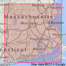
- New England province
Summary:
Authors use Pondville Conglomerate. Consists of quartz conglomerate having abundant sandy matrix; also includes boulder conglomerate, arkose, and fossil plants. Age is Early Pennsylvanian.
Source: GNU records (USGS DDS-6; Reston GNULEX).
- Usage in publication:
-
- Pondville Conglomerate
- Modifications:
-
- Revised
- Dominant lithology:
-
- Conglomerate
- Graywacke
- Shale
- AAPG geologic province:
-
- New England province
Summary:
Author here assigns the Sachuest Arkose, Purgatory Conglomerate, Pondville Conglomerate, Wamsutta Formation, Rhode Island Formation, and Dighton Conglomerate to the Rhode Island Group of northern Rhode Island and southeastern Massachusetts. Pondville is described as polymictic conglomerates, graywackes, and shales. Most pebbles and cobbles are quartzite with some granite and schist. Unit is approximately 100 m thick. Unconformably overlies Late Proterozoic and Cambrian rocks. Grades laterally into and upward into Wamsutta Formation in the northern Narragansett basin. Age may range from Westphalian A to B (Early to Middle Pennsylvanian). Rocks previously mapped as Pondville in the southern Narragansett basin are now referred to Sachuest Arkose.
[Usage of the Rhode Island in this report is not recommended. According to Article 19f of the NACSN code (1983), "In changing the rank of a unit, the same name may not be applied both to the unit as a whole and to a part of it."]
Source: GNU records (USGS DDS-6; Reston GNULEX).
- Usage in publication:
-
- Pondville Conglomerate*
- Modifications:
-
- Overview
- AAPG geologic province:
-
- New England province
Summary:
Pondville Conglomerate is present in Narragansett and Norfolk basins. Although Chute (1964, 1966, 1969) recognized a lower boulder conglomerate member and an upper sandstone to pebble conglomerate member in the Pondville in the northeast part of the basin, such a division is not readily made to the southwest because of facies changes. Upper member grades into and interfingers with Wamsutta Formation. Basal beds nonconformably overlie Dedham Granite in northern part of Narragansett basin. Age of deposits in Narragansett and Norfolk basins ranges from Early to Late Pennsylvanian; however, Skehan and Murray (1980) assigned lower part of Pondville to Mississippian. Further study may reveal even older Paleozoic sediments in Narragansett basin. Report includes geologic maps, correlation charts. [Age is not formally changed here. Chapters A-J in U.S. Geological Survey Professional Paper 1366 are intended as explanations and (or) revisions to the 1:250,000-scale MA State bedrock geologic map of Zen and others (1983).]
Source: GNU records (USGS DDS-6; Reston GNULEX).
For more information, please contact Nancy Stamm, Geologic Names Committee Secretary.
Asterisk (*) indicates published by U.S. Geological Survey authors.
"No current usage" (†) implies that a name has been abandoned or has fallen into disuse. Former usage and, if known, replacement name given in parentheses ( ).
Slash (/) indicates name conflicts with nomenclatural guidelines (CSN, 1933; ACSN, 1961, 1970; NACSN, 1983, 2005, 2021). May be explained within brackets ([ ]).