The National Geologic Map Database is migrating to a new infrastructure. We apologize for any service disruptions during this process.
|
|---|


- Usage in publication:
-
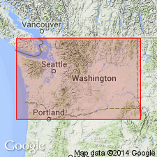
- Pomona Basalt
- Modifications:
-
- Named
- Dominant lithology:
-
- Basalt
- AAPG geologic province:
-
- Columbia basin
Summary:
zzzzzPg. 6541-6542. The 4 youngest Yakima Basalt flows intertongue with volcaniclastic and arkosic sediments of the Ellensburg Formation in much of south-central Washington. From oldest to youngest these are: Umatilla Basalt, Pomona Basalt, Elephant Mountain Basalt, and Ward Gap Basalt. Umatilla and Pomona flows are separated by Selah member of the Ellensburg. Rattlesnake Ridge Member (new) of the Ellensburg lies between the Pomona and Elephant Mountain flows. [Age not stated in abstract.]
[Named for town of Pomona on Yakima River, north of Yakima, WA.]
Source: US geologic names lexicon (USGS Bull. 1350, p. 588-589); GNU records (USGS DDS-6; Menlo GNULEX).
- Usage in publication:
-
- Pomona flow
- Modifications:
-
- Revised
- AAPG geologic province:
-
- Columbia basin
Summary:
Pg. 275-276. Pomona flow, the third youngest flow of the late Yakima Basalt in south-central Washington has been defined and clearly distinguished from underlying and overlying flows by following features: geometry and structures (total thickness, zones of characteristic jointing, thickness and form of columns, pipe vesicles, and vesicle cylinders); textures (crystallinity, grain size, phenocrysts, glomeroporphyritic clots); composition (olivine and pyroxene, and total chemical composition); and weathering features. Field recognition of Pomona flow is aided by its association with a distinctive tuff containing accretionary lapilli. Over much of area this tuff was welded or fused at the contact by overriding hot Pomona flow. In some places the Pomona flow burrowed into this tuff, producing a peperite. Pomona flow and associated tuff cover area of at least 6,000 sq mi. West of Yakima, Pomona flow decreases rapidly in thickness. The overlying Elephant Mountain flow and Ward Gap flow thin toward the west; neither flow extends west of Yakima.
Source: US geologic names lexicon (USGS Bull. 1350, p. 588-589); GNU records (USGS DDS-6; Menlo GNULEX).
- Usage in publication:
-
- Pomona flow
- Modifications:
-
- Areal extent
- AAPG geologic province:
-
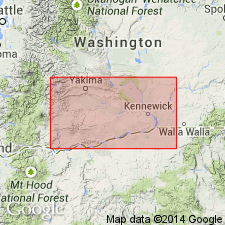
- Eastern Columbia basin
Summary:
Pg. G11. Referred to as one of the Saddle Mountains flows. Pomona flow of Saddle Mountains Member of Yakima Basalt of Columbia River Group.
Source: US geologic names lexicon (USGS Bull. 1350, p. 588-589).
- Usage in publication:
-
- Pomona Basalt Member
- Modifications:
-
- Revised
- AAPG geologic province:
-
- Columbia basin
Summary:
Referred to as Pomona Basalt Member of Yakima Basalt Formation. Well-formed fanning columns (average diameter 20 cm) make up prominent entablature. Contains small plagioclase and olivine phenocrysts. Differs from overlying and underlying late Yakima-type flows by higher calcium and magnesium content, lower content of iron, alkalis, and titania, and corresponding differences in modal and mineral composition. Is generally 30 m (100 feet) thick. Overlies Selah Member of Ellensburg Formation. Selah Member has been welded by Pomona Basalt Member in many places.
[Reference is also made to Pomona Basalt and to Pomona flow (US geologic names lexicon, USGS Bull. 1350, p. 589).]
Source: GNU records (USGS DDS-6; Menlo GNULEX); supplemental information from US geologic names lexicon (USGS Bull. 1350, p. 588-589).
- Usage in publication:
-
- Pomona Flow*
- Modifications:
-
- Adopted
- AAPG geologic province:
-
- Columbia basin
Summary:
Pomona Basalt Member (of Yakima Basalt Formation) of Schmincke (1967) adopted as Pomona Flow and assigned to Yakima Basalt. [Age is Miocene or Pliocene.]
Source: GNU records (USGS DDS-6; Menlo GNULEX).
- Usage in publication:
-
- Pomona Member*
- Modifications:
-
- Revised
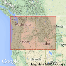
- Areal extent
- Age modified
- Reference
- Dominant lithology:
-
- Basalt
- AAPG geologic province:
-
- Eastern Columbia basin
Summary:
Pg. G2-G3 (fig. 1), G46-G48; see also H.-U. Schmincke, 1967, Stratigraphy and petrography of four upper Yakima Basalt flows in south-central Washington: GSA Bull., v. 78, p. 1385-1422. Pomona Flow (Helz and others, 1976) is renamed Pomona Member and assigned to Saddle Mountains Basalt of Yakima basalt subgroup [informal] of Columbia River Basalt Group. Covers much of southwest part of Columbia Plateau from Saddle Mountains in south-central Washington, and extending into northernmost Oregon; flow presumably advanced into Snake River Canyon from source in western Idaho. Characterized by small wedge-shaped phenocrysts of plagioclase with scattered clinopyroxene and olivine. Some plagioclase phenocrysts riddled with clinopyroxene inclusions. Has maximum preserved thickness of 100 m; averages 30 m thick outside the Snake River Canyon. At most localities, is composed of a single sparsely phyric flow of Pomona chemical type. Has reversed magnetic polarity. Overlies with erosional unconformity Esquatzel Member; underlies with erosional unconformity Elephant Mountain Member (both of Saddle Mountains Basalt). Four reference localities designated. Age (shown in stratigraphic section) is middle Miocene, based on about 12 Ma (McKee and others, 1977). Report includes stratigraphic charts, chemical analyses.
Type locality: roadcuts along Canyon Road (old Highway 97) [Route 821] and a nearby quarry, in NE/4 sec. 17, T. 14 N., R. 19 E., near town of Pomona, Pomona 7.5-min quadrangle, Yakima Co., south-central WA; [approx. Lat. 46 deg. 42 min. 20 sec. N., Long. 120 deg. 28 min. 15 sec. W.].
Reference sections (all in south-central WA):
(1) 2 cooling units overlain by Elephant Mountain Member in roadcuts along Highway 17, 1 km north of Mesa [approx. Lat. 46 deg. 35 min. 15 sec. N., Long. 119 deg. 00 min. 15 sec. W., Mesa West 7.5-min quadrangle, Franklin Co.];
(2) peperite and invasive relations into a vitric tuff in Ellensburg Formaiton in railroad cuts and natural exposures 3 to 6 km upstream from Ice Harbor Dam on north side of Snake River, from center sec. 18 upriver to W/2 sec. 4, T. 9 N., R. 32 E., Levey SE [Levey] 7.5-min quadrangle [from approx. Lat. 46 deg. 15 min. 40 sec. N., Long. 118 deg. 51 min. 30 sec. W. to Lat. 46 deg. 17 min. 30 sec. N., Long. 118 deg. 49 min. 15 sec. W., Franklin Co.];
(3) spectacular columnar jointing in remnant of intracanyon flow in roadcut and roadside quarry along Hastings Hill Road, in NE/4 NE/4 sec. 3, T. 13 N., R. 40 E., Hay [Central Ferry] 7.5-min quadrangle [approx. Lat. 46 deg. 38 min. 45 sec. N., Long. 117 deg. 46 min. 03 sec. W., Garfield Co.];
(4) columnar remnant of intracanyon flow in quarry just east of Silcott, in SW/4 sec. 21, T. 11 N., R. 45 E., Silcott [Silcott Island] 7.5-min quadrangle [approx. Lat. 46 deg. 25 min. 00 sec. N., Long. 117 deg. 10 min. 55 sec. W., Asotin Co.].
[Additional locality information from USGS GNIS database, TopoZone (http://topozone.com), Montana State Univ. Graphical Locator; accessed October 3, 2007.]
[Yakima basalt subgroup considered informal and should not be capitalized. "Subgroup" not recognized as a formal stratigraphic rank term (CSN, 1933; ACSN, 1961, 1970; NACSN, 1983, 2005, 2021). Columbia River Basalt Group adopted by the ID, OR, and WA Geol. Surveys, and the USGS.]
Source: Publication; GNU records (USGS DDS-6; Menlo GNULEX, supplemental information from Denver GNULEX).
For more information, please contact Nancy Stamm, Geologic Names Committee Secretary.
Asterisk (*) indicates published by U.S. Geological Survey authors.
"No current usage" (†) implies that a name has been abandoned or has fallen into disuse. Former usage and, if known, replacement name given in parentheses ( ).
Slash (/) indicates name conflicts with nomenclatural guidelines (CSN, 1933; ACSN, 1961, 1970; NACSN, 1983, 2005, 2021). May be explained within brackets ([ ]).