

- Usage in publication:
-
- Pollack quartz latite
- Modifications:
-
- Named
- Dominant lithology:
-
- Quartz latite
- AAPG geologic province:
-
- Orogrande basin
- Basin-and-Range province
Summary:
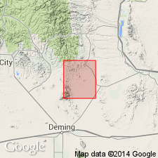
Named from its exposure on Pollack Creek, although the type area is along Taylor Creek, Sierra Co, NM in the Orogrande basin. Is exposed over an area of 4 sq mi in north-central part of Lake Valley quad on Macho, Taylor, and Pollack Creeks, Sierra Co, and in northwest corner of quad, in Grant Co, Basin-and-Range province. Two small outcrops occur on west side of White Rock Creek at junction with Fuller Creek. Consists of quartz latite ranging in color from a dominant pinkish brown to light red and purple. Contains phenocrysts of andesine and sanidine as much as 2 cm long, with smaller phenocrysts of quartz, brown hornblende, and greenish-brown biotite. Rock contains 25 percent phenocrysts. Attains a maximum thickness of about 300 ft. Is older than Razorback formation; younger than Mimbres Peak formation. Though the rock superficially resembles Kneeling Nun tuff (new), it more nearly resembles a rock flow than a welded tuff; it lacks columnar jointing. Kneeling Nun and Pollack are very different chemically. Pollack lies unconformably on both rhyolite tuffs and rhyolites, and thus appears to be younger than Kneeling Nun formation, which has been found to lie only on tuffs of Sugarlump formation and is in turn overlain by rhyolites. Flows of the Razorback formation overlie Pollack along Taylor Creek. Shown on chart as late Tertiary in age. Geologic map, generalized stratigraphic chart.
Source: GNU records (USGS DDS-6; Denver GNULEX).
- Usage in publication:
-
- Pollack quartz latite
- Modifications:
-
- Contact revised
- Overview
- AAPG geologic province:
-
- Basin-and-Range province
Summary:
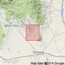
Is one of five units assigned to the "Upper volcanic series". Lower contact revised in that Pollack rhyolite overlies Mimbres Peak rhyolite (named). Is found only in northeast corner of quad; mapped in the Gila National Forest, Grant Co., NM in the Basin-and-Range province where it consists of about 400 ft of flows, locally glassy at base. All rock types contain phenocrysts of quartz, sanidine, oligoclase, and biotite. Sanidine phenocrysts are as long as 12 mm. The rock is purple-gray. Lies below Santa Fe conglomerates in this quad. and below the newly named "Razorback andesite" in the Lake Valley quad. Tertiary age assigned.
Source: GNU records (USGS DDS-6; Denver GNULEX).
For more information, please contact Nancy Stamm, Geologic Names Committee Secretary.
Asterisk (*) indicates published by U.S. Geological Survey authors.
"No current usage" (†) implies that a name has been abandoned or has fallen into disuse. Former usage and, if known, replacement name given in parentheses ( ).
Slash (/) indicates name conflicts with nomenclatural guidelines (CSN, 1933; ACSN, 1961, 1970; NACSN, 1983, 2005, 2021). May be explained within brackets ([ ]).