- Usage in publication:
-
- Pole Canyon member
- Modifications:
-
- Named
- Dominant lithology:
-
- Quartzite
- Sandstone
- Limestone
- AAPG geologic province:
-
- Wasatch uplift
- Great Basin province
Summary:
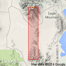
Named as the upper member (of 5 members) of Oquirrh formation for Pole Canyon, Utah Co., UT on the Wasatch uplift. Type locality is on an east-trending spur on west side of Pole Canyon in secs. 2 and 11, T 6 S, R 3 W, Utah Co. Conformably overlies the newly named Lewiston Peak member of Oquirrh. Contact placed at base of first massive to thick-bedded orthoquartzite (Pole Canyon) that rests on burnt chert and siliceous limestones (Lewiston Peak). Is confined largely to outcrops in lower part of Pole Canyon south of Fairfield in the southern Oquirrh Mountains. Geologic map of the southern Oquirrh Mountains shows member in Tooele Co. (Great Basin province) as well as in Utah Co. The next younger unit mapped is designated Quaternary deposits. Member consists of interbedded and intercalated orthoquartzites, calcareous sandstone, crystalline limestone, cherty fossiliferous-fragmental limestone, and argillaceous to silty limestone, some of which contains chert nodules. Small scale stratification suggests deposition in the neritic zone. Fusulinids of Virgilian, Late Pennsylvanian age. Age of Pole Canyon may be younger than Virgilian in that some 300 ft of sandstone, orthoquartzite, argillaceous and sandy limestones mapped as part of Pole Canyon in the "Pole Canyon Syncline" may be Wolfcampian or Early Permian. [See statement for Oquirrh under Bissell, 1959]
Source: GNU records (USGS DDS-6; Denver GNULEX).
For more information, please contact Nancy Stamm, Geologic Names Committee Secretary.
Asterisk (*) indicates published by U.S. Geological Survey authors.
"No current usage" (†) implies that a name has been abandoned or has fallen into disuse. Former usage and, if known, replacement name given in parentheses ( ).
Slash (/) indicates name conflicts with nomenclatural guidelines (CSN, 1933; ACSN, 1961, 1970; NACSN, 1983, 2005, 2021). May be explained within brackets ([ ]).

