- Usage in publication:
-
- Pokerville Member*
- Modifications:
-
- Named
- Adopted
- Dominant lithology:
-
- Breccia
- AAPG geologic province:
-
- Sierra Nevada province
Summary:
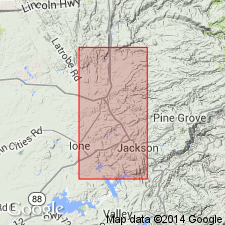
Named for early name of present town of Plymouth, CA. Type locality: exposures on southern bank of Cosumnes River, sec 14-15 T8N R10E, Amador Co, CA. Adopted as third member of four of Logtown Ridge Formation. Consists of coarsely porphyritic augite basalt clasts in volcanic breccia with basalt flows, pillow lavas and pyroclastic greenstone. Is 1370 m thick. Conformably overlies Goat Hill Member (new). Is uppermost of three members of Logtown Ridge Formation except east and southeast of Drytown where it underlies New Chicago Member (new). Is probably Callovian but may extend upward into latest Oxfordian(?) or early Kimmeridgian(?) depending on location. Age on Cosumnes River is Callovian [Late Jurassic in this paper].
Source: GNU records (USGS DDS-6; Menlo GNULEX).

- Usage in publication:
-
- Pokerville Member*
- Modifications:
-
- Age modified
- AAPG geologic province:
-
- Sierra Nevada province
Summary:
Age changed based on Middle-Upper Jurassic boundary change based on top of Callovian-bottom of Oxfordian. Thus Pokerville Member if Late Jurassic and Middle(?) Jurassic age.
Source: GNU records (USGS DDS-6; Menlo GNULEX).
For more information, please contact Nancy Stamm, Geologic Names Committee Secretary.
Asterisk (*) indicates published by U.S. Geological Survey authors.
"No current usage" (†) implies that a name has been abandoned or has fallen into disuse. Former usage and, if known, replacement name given in parentheses ( ).
Slash (/) indicates name conflicts with nomenclatural guidelines (CSN, 1933; ACSN, 1961, 1970; NACSN, 1983, 2005, 2021). May be explained within brackets ([ ]).

