

- Usage in publication:
-
- Poison Honey beds
- Modifications:
-
- Informally named
- Dominant lithology:
-
- Sandstone
- Conglomerate
- AAPG geologic province:
-
- Appalachian basin
Summary:
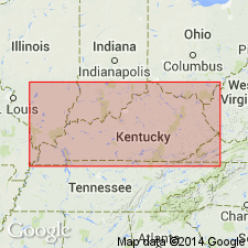
Sequence of unique rocks in the Lee Formation of KY is here informally named the Poison Honey beds. Unit occurs on the western outcrop margin of the Pennsylvanian rocks in the Eastern Kentucky Coal Field. Beds consist of complex matrix-supported, shale-clast conglomerates and fine-grained sandstones. They are texturally different from other sandstones described in this part of the basin, exhibit paleocurrents opposite from those in surrounding units, and may indicate Pennsylvanian fault movement. Interpreted as composite mass flow deposit. The beds are exposed only in roadcuts of Hwy 80 and do not continue beyond limits of the hillside bounding the Rockcastle River and Pine Creek. Sharply overlies informal Pine Creek sandstone of the Lee Formation; truncated by unnamed channel-fill deposits of the Lee Formation. Thickness estimated at 10 m from cross-section (fig. 9).
Source: GNU records (USGS DDS-6; Reston GNULEX).
For more information, please contact Nancy Stamm, Geologic Names Committee Secretary.
Asterisk (*) indicates published by U.S. Geological Survey authors.
"No current usage" (†) implies that a name has been abandoned or has fallen into disuse. Former usage and, if known, replacement name given in parentheses ( ).
Slash (/) indicates name conflicts with nomenclatural guidelines (CSN, 1933; ACSN, 1961, 1970; NACSN, 1983, 2005, 2021). May be explained within brackets ([ ]).