The National Geologic Map Database is migrating to a new infrastructure. We apologize for any service disruptions during this process.
|
|---|


- Usage in publication:
-
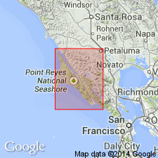
- Point Reyes Conglomerate
- Modifications:
-
- Named
- Dominant lithology:
-
- Conglomerate
- Sand
- AAPG geologic province:
-
- California Coast Ranges province
Summary:
Type section designated as outcrops at lighthouse on west end of Point Reyes, Marin Co, CA. Weaver (1969) mapped outcrops as part of Laird Sandstone in Tomales Point area. Consists of coarse conglomerate of granitic rocks in matrix of granitic sand and interbedded with silty, micaceous sand. Forms craggy or stack-like outcrops with vertical jointing. Is over 200 thick with range up to 400 m. Top of unit is eroded. Unconformably overlies granitic basement rocks; unconformably underlies Drakes Bay Formation. Is Paleocene age.
Source: GNU records (USGS DDS-6; Menlo GNULEX).
For more information, please contact Nancy Stamm, Geologic Names Committee Secretary.
Asterisk (*) indicates published by U.S. Geological Survey authors.
"No current usage" (†) implies that a name has been abandoned or has fallen into disuse. Former usage and, if known, replacement name given in parentheses ( ).
Slash (/) indicates name conflicts with nomenclatural guidelines (CSN, 1933; ACSN, 1961, 1970; NACSN, 1983, 2005, 2021). May be explained within brackets ([ ]).