The National Geologic Map Database is migrating to a new infrastructure. We apologize for any service disruptions during this process.
|
|---|


- Usage in publication:
-
- Point Peak shale member*
- Modifications:
-
- Named
- Dominant lithology:
-
- Shale
- AAPG geologic province:
-
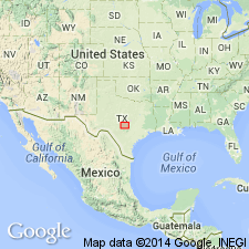
- Llano uplift
Summary:
Named as a member (one of five) of Wilberns formation for a conspicuous hill about 4 mi northeast of Lone Grove, Llano Co., TX on the Llano uplift. Type section is on south slope of Point Peak. Is about 270 ft thick at its type; averages 160 ft thick; thickens across uplift from southeast to northeast; thinnest section 25 ft thick in at the Klett ranch along Pedernales River, Blanco Co. Overlies Morgan Creek limestone member (named) Of Wilberns. Underlies San Saba limestone member (named) of Wilberns. Consists of well-bedded, soft, greenish, calcareous shale with subordinate fine grained compact dolomite, medium- to fine-grained glauconitic limestone; ovlitic limestone near top, and intraformational conglomerate. Scattered stromatolitic bioherms coalesce to form biostromes. The conglomerates are layers of compact limestone up to 18 inches thick, crowded with angular flattened limestone pebbles. Fossils (brachiopods) graptolites. Cross sections. Of Late Cambrian age.
Source: GNU records (USGS DDS-6; Denver GNULEX).
For more information, please contact Nancy Stamm, Geologic Names Committee Secretary.
Asterisk (*) indicates published by U.S. Geological Survey authors.
"No current usage" (†) implies that a name has been abandoned or has fallen into disuse. Former usage and, if known, replacement name given in parentheses ( ).
Slash (/) indicates name conflicts with nomenclatural guidelines (CSN, 1933; ACSN, 1961, 1970; NACSN, 1983, 2005, 2021). May be explained within brackets ([ ]).