The National Geologic Map Database is migrating to a new infrastructure. We apologize for any service disruptions during this process.
|
|---|


- Usage in publication:
-
- Point of Rocks sandstone
- Modifications:
-
- [Areal extent]
- Dominant lithology:
-
- [Sandstone]
- AAPG geologic province:
-
- San Joaquin basin
Summary:
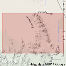
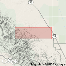
Pg. 1566 (fig. 9). Point of Rocks sandstone. Named [merely shown] on columnar section of upper Eocene strata in Devils Den area, southern California. Underlies Kreyenhagen and overlies "Tejon" shale.
Source: US geologic names lexicon (USGS Bull. 1200, p. 3080-3081).
- Usage in publication:
-
- [Point of Rocks sandstone]
- Modifications:
-
- [Original reference]
- Dominant lithology:
-
- Sandstone
- AAPG geologic province:
-
- San Joaquin basin
Summary:
Pg. 496, 497 (fig. 211). [Point of Rocks sandstone.] Described as tawny massive cavernous cross-bedded medium to coarse quartzose sandstone; contains large chocolate-brown concretions in lower part; includes two thin silty claystone beds. Thickness 3,005 feet. Underlies Welcome formation; overlies Gredal formation (new). Age is late Eocene.
Source: US geologic names lexicon (USGS Bull. 1200, p. 3080-3081).
- Usage in publication:
-
- [Point of Rocks sandstone]
- Modifications:
-
- Areal extent
- AAPG geologic province:
-
- San Joaquin basin
Summary:
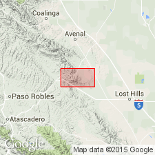
Pg. 4 (table 1), 5 (table 2), 7, pl. 1. [Point of Rocks sandstone.] Described in Bitterwater Creek area, Kern County, southern California, as coarse- to medium-grained sandstone characterized by red-brown "cannonball" concretions of [calcarenite] sandstone up to 4 or 5 feet in diameter. Maximum thickness 600 feet; southeastward along strike there is a gradual decrease in apparent thickness due to progressive overlap by younger Santos shale member (new) of Monterey formation and at one locality Twisselmann sandstone member (new) of the Monterey. In Antelope Valley, sandstone wedges out or is truncated by either the McDonald shale or Tulare sediments. Age is late Eocene.
Source: US geologic names lexicon (USGS Bull. 1200, p. 3080-3081).
- Usage in publication:
-
- Point of Rocks sandstone member
- Modifications:
-
- Revised
- Biostratigraphic dating
- AAPG geologic province:
-
- San Joaquin basin
Summary:
Pg. 10, 11, 19, 70, 101, 282. Report makes several references to Point of Rocks sandstone member of Tejon formation. At Media Agua Creek, bulk of Point of Rocks member was deposited during early Narizian [late Eocene], UVIGERINA CHURCHI time.
Source: US geologic names lexicon (USGS Bull. 1200, p. 3080-3081).
- Usage in publication:
-
- Point of Rocks sandstone and shale member
- Modifications:
-
- Areal extent
- AAPG geologic province:
-
- San Joaquin basin
Summary:
Pg. 13, 14. Chart and columnar section of Chico-Martinez Creek area, [Kern County, south-central California], show Point of Rocks sandstone and shale member of Tejon formation unconformable below Salt Creek shale member of Tejon formation.
Source: US geologic names lexicon (USGS Bull. 1200, p. 3080-3081).
- Usage in publication:
-
- [Point of Rocks sandstone]
- Modifications:
-
- Not used
- AAPG geologic province:
-
- San Joaquin basin
Summary:
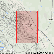
Pg. 28. Conspicuous craggy sandstone at Red Man Rocks, Orchard Peak area, has been mapped as Eocene, usually as Point of Rocks whose type locality lies 4 miles southeast of Devils Den. Craggy sandstone in northeast corner of area has been regarded as Cretaceous. In present report, both exposures are mapped as Upper Cretaceous Red Man sandstone (new).
Source: US geologic names lexicon (USGS Bull. 1200, p. 3080-3081).
For more information, please contact Nancy Stamm, Geologic Names Committee Secretary.
Asterisk (*) indicates published by U.S. Geological Survey authors.
"No current usage" (†) implies that a name has been abandoned or has fallen into disuse. Former usage and, if known, replacement name given in parentheses ( ).
Slash (/) indicates name conflicts with nomenclatural guidelines (CSN, 1933; ACSN, 1961, 1970; NACSN, 1983, 2005, 2021). May be explained within brackets ([ ]).