

- Usage in publication:
-
- Point Lookout sandstone*
- Modifications:
-
- Named
- Dominant lithology:
-
- Sandstone
- AAPG geologic province:
-
- Paradox basin
Summary:
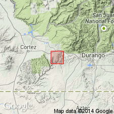
Named as basal formation of Mesaverde group (rank raised) for exposures in cliffs at Point Lookout, about 7 1/2 mi southwest of Mancos, Montezuma Co, CO in Paradox basin. No type locality designated. Extends south into La Plata Co in San Juan basin. Is a massive sandstone, 250 to 300 ft thick, that lies above Mancos shale and below Menefee formation (new name) of Mesaverde group. Assigned to Late Cretaceous. Formerly called the "Lower Escarpment."
Source: GNU records (USGS DDS-6; Denver GNULEX).
- Usage in publication:
-
- Point Lookout sandstone
- Modifications:
-
- Revised
- AAPG geologic province:
-
- San Juan basin
Summary:
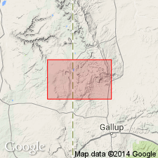
Upper Cretaceous Point Lookout sandstone is the third from base of five formations that are part of Mesaverde group (new rank) in Tohatchi quad, San Juan basin, NM. Ranges from 25 ft thick near Crevasse Canyon to 320 ft thick southeast of Todilto Park. The lower cliff-making unit, named Hosta sandstone tongue, a revised assignment from Mesaverde formation to Point Lookout in this report, is a homogeneous colored pale-orange to pale-yellowish-gray, massive and faintly cross-bedded, medium- to coarse-grained arkosic sandstone. Hosta is separated from main body of Point Lookout by Satan Tongue of Mancos shale. The main body of Point Lookout differs from Mancos in color being a darker shade of orange and having abundant iron-oxide concretions. Overlies Crevasse Canyon formation named in this report. Assigned to Late Cretaceous.
Source: GNU records (USGS DDS-6; Denver GNULEX).
- Usage in publication:
-
- Point Lookout sandstone*
- Modifications:
-
- Revised
- AAPG geologic province:
-
- San Juan basin
Summary:
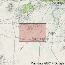
A sandstone about 50 ft thick [base not exposed?] at the top of the Point Lookout sandstone, lower formation of Mesaverde group, named the North Hogback tongue. The North Hogback whose only known occurrence is in secs 10 and 11, T30N, R16W, intertongues with the overlying Menefee formation. The formation in the report area--San Juan basin, NM--is 350 ft thick and is composed of a lower 50 to 100 ft thick fine-grained, gray-brown, thin-bedded sandstone and an upper 200 to 250 ft thick gray to white, fine- to medium-grained, even textured, massive sandstone. Is of littoral marine origin. Cross section. Geologic map. Of Late Cretaceous age.
Source: GNU records (USGS DDS-6; Denver GNULEX).
- Usage in publication:
-
- Point Lookout sandstone*
- Modifications:
-
- Revised
- AAPG geologic province:
-
- San Juan basin
Summary:
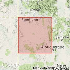
Assigned as third formation from base (of six) to Mesaverde group (raised to group rank). Replaces use of Hosta sandstone member and upper part of Hosta where Hosta is undivided or where lower part of Hosta is missing. Hosta restricted to lower part of Hosta of earlier reports. Term Mesaverde raised to group rank throughout San Juan basin of southwest CO and northwest NM. Divided into: 1) lower unit called Hosta tongue (restricted to lower Hosta of earlier reports) and, 2) an upper part. Hosta is separated from the upper part of Point Lookout by Satan tongue of Mancos shale. Hosta is underlain by Gibson coal member of Crevasse Canyon formation. Point Lookout is overlain by Cleary coal member (a new name in this report) of Menefee formation. Where the upper part of Point Lookout wedges out, Cleary rests on Gibson. Small geologic map. Diagrammatic cross section. Of Late Cretaceous age.
Source: GNU records (USGS DDS-6; Denver GNULEX).
- Usage in publication:
-
- Point Lookout Sandstone
- Modifications:
-
- Areal extent
- AAPG geologic province:
-
- San Juan basin
Summary:
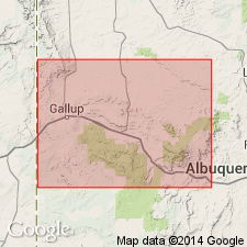
About 25 mi northeast of Gallup, NM near Coal Mine Canyon, Hosta Tongue of Point Lookout pinches out. South of that locality, Gibson Coal Member of Crevasse Canyon Formation and Cleary Coal Member of Menefee Formation cannot be separated. [The stratigraphic restriction by Beaumont and others, 1956 of Gibson to only the lower part of what Sears in 1925 assigned to Gibson, and application of the name Cleary by Beaumont and others to the upper part of what Sears assigned to Gibson has set up a formation contact that cannot be mapped according to these authors.]
Source: GNU records (USGS DDS-6; Denver GNULEX).
For more information, please contact Nancy Stamm, Geologic Names Committee Secretary.
Asterisk (*) indicates published by U.S. Geological Survey authors.
"No current usage" (†) implies that a name has been abandoned or has fallen into disuse. Former usage and, if known, replacement name given in parentheses ( ).
Slash (/) indicates name conflicts with nomenclatural guidelines (CSN, 1933; ACSN, 1961, 1970; NACSN, 1983, 2005, 2021). May be explained within brackets ([ ]).