The National Geologic Map Database is migrating to a new infrastructure. We apologize for any service disruptions during this process.
|
|---|


- Usage in publication:
-
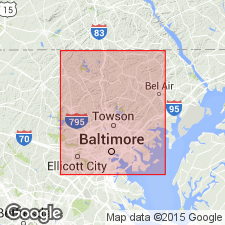
- Pleasant Grove Schist
- Modifications:
-
- Named
- Dominant lithology:
-
- Schist
- AAPG geologic province:
-
- Piedmont-Blue Ridge province
Summary:
The Wissahickon is raised in rank in this report and subdivided into six formations. Name Pleasant Grove Schist of Wissahickon Group (of Glenarm Supergroup) is proposed in this report for schists exposed near Pleasant Grove Church in west-central Baltimore Co. Unit consists of uniform, fine-grained plagioclase-chlorite-muscovite-quartz schist, locally with magnetite. Commonly accompanied by numerous, thin veins and lenses of milky quartz and, in places, laminae and thin beds of quartzite, giving the rock a seamed appearance. Thickness varies from 0 to 2.2 km. Overlies Piney Run Formation or Oella Formation and underlies Prettyboy Schist, all of Wissahickon. Age of the Wissahickon is listed in map explanation as Cambro-Ordovician(?).
Source: GNU records (USGS DDS-6; Reston GNULEX).
- Usage in publication:
-
- Pleasant Grove Schist†
- Modifications:
-
- Abandoned
- AAPG geologic province:
-
- Piedmont-Blue Ridge province
Summary:
Pleasant Grove Schist as mapped by Crowley (1976) consists of sheared Mather Gorge Formation, Prettyboy Schist, and Marburg Formation and is not a separate formation. It is herein abandoned.
Source: GNU records (USGS DDS-6; Reston GNULEX).
For more information, please contact Nancy Stamm, Geologic Names Committee Secretary.
Asterisk (*) indicates published by U.S. Geological Survey authors.
"No current usage" (†) implies that a name has been abandoned or has fallen into disuse. Former usage and, if known, replacement name given in parentheses ( ).
Slash (/) indicates name conflicts with nomenclatural guidelines (CSN, 1933; ACSN, 1961, 1970; NACSN, 1983, 2005, 2021). May be explained within brackets ([ ]).