

- Usage in publication:
-
- Plantation Tongue
- Modifications:
-
- Named
- Dominant lithology:
-
- Dolomite
- AAPG geologic province:
-
- Florida platform
Summary:
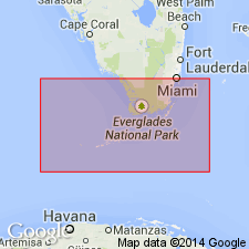
Plantation Tongue of Rebecca Shoal Dolomite here named for town in Monroe Co., southeastern FL. Unit is a subsurface barrier-reef complex with a fine crystalline texture and consists of brown to cream anhedral dolomite. Thickness in type well is 218 m. Overlies Late Cretaceous Card Sound Dolomite; interfingers with Pine Key Formation; and underlies Paleocene Tavernier Tongue, also of Rebecca Shoal Dolomite. Age of Plantation is Late Cretaceous.
Source: GNU records (USGS DDS-6; Reston GNULEX).
- Usage in publication:
-
- Plantation Tongue
- Modifications:
-
- Overview
- AAPG geologic province:
-
- Florida platform
Summary:
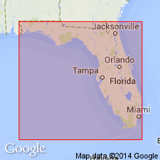
Three tongues of the Rebecca Shoal Dolomite extend into the lagoonal facies (Cedar Keys and Pine Key facies). The Plantation Tongue overlies the basal Card Sound Tongue (assigned in Winston (1989) and in this report to the Rebecca Shoal) in at least two locales. The Card Sound has been penetrated in only two wells in the FL Keys and three wells on the Sarasota arch, but there is no evidence to connect the two locales. In one well, the younger Plantation Tongue has coalesced with the Card Sound and in several other wells the still younger Tavernier Tongue has coalesced with the Plantation. The Plantation ranges in thickness from 310 ft to more than 1275 ft. The Tavernier Tongue extends into the lagoon farther than the other two and is the only one of the three tongues to extend into southeastern GA. The Plantation is shown on the isopach map as surrounding the lower half of the FL peninsula. No paleontologic data available to determine the age of the Rebecca Shoal or its three tongues. Earliest appearance of Card Sound Tongue is 100 ft above the Lower Cretaceous. This establishes an early Late Cretaceous age for the lower reef section and through correlation of the Tavernier Tongue with the Cedar Keys Formation, a Paleocene age is suggested for the upper reef section. A late Late Cretaceous age is suggested for the Plantation Tongue through correlation with the upper part of the Pine Key Formation.
Source: GNU records (USGS DDS-6; Reston GNULEX).
For more information, please contact Nancy Stamm, Geologic Names Committee Secretary.
Asterisk (*) indicates published by U.S. Geological Survey authors.
"No current usage" (†) implies that a name has been abandoned or has fallen into disuse. Former usage and, if known, replacement name given in parentheses ( ).
Slash (/) indicates name conflicts with nomenclatural guidelines (CSN, 1933; ACSN, 1961, 1970; NACSN, 1983, 2005, 2021). May be explained within brackets ([ ]).