The National Geologic Map Database is migrating to a new infrastructure. We apologize for any service disruptions during this process.
|
|---|


- Usage in publication:
-
- Plainfield quartz schist
- Modifications:
-
- Original reference
- Dominant lithology:
-
- Schist
- Quartzite
- AAPG geologic province:
-
- New England province
Summary:
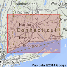
Pg. 114, 182, and map. Plainfield quartz schist. Highly quartzose, but varies in texture from a finely divided quartz schist to an almost massive quartzite, and also to a dark-colored rock resembling slate. Crosses Plainfield Township, [Windham County], eastern Connecticut. Believed to be only a prominent and clearly marked variation of Putnam gneiss. It seems to be part of a series that includes Putnam gneiss and to be the oldest sedimentary formation in the region. Resembles Poughquag quartzite.
Source: US geologic names lexicon (USGS Bull. 896, p. 1677).
- Usage in publication:
-
- Plainfield Formation*
- Modifications:
-
- Age modified
- Areal extent
- AAPG geologic province:
-
- New England province
Summary:
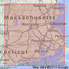
Age designated as Proterozoic Z because it is intruded by Proterozoic Z granitoid rocks of Rhode Island batholith as is shown by other workers. Plainfield and Westboro Formations are similar in composition and structural-stratigraphic position, and correlate with part or all of Blackstone Group. Plainfield extends into MA in and along flank of Rhode Island batholith.
Source: GNU records (USGS DDS-6; Reston GNULEX).

- Usage in publication:
-
- Plainfield Formation*
- Modifications:
-
- Overview
- AAPG geologic province:
-
- New England province
Summary:
Used as Plainfield Formation of Proterozoic Z age. Consists of quartzite, pelitic schist, minor calc-silicate rock, and amphibolite.
Source: GNU records (USGS DDS-6; Reston GNULEX).
- Usage in publication:
-
- Plainfield Formation
- Modifications:
-
- Overview
- AAPG geologic province:
-
- New England province
Summary:
Plainfield Formation is lowermost part of the exposed Avalonian sequence over most of the Hope Valley terrane. (Hope Valley and Esmond-Dedham terranes combined in this report to compose the Avalon superterrane.) Author cautions against correlation with Quinnville Formation and Westboro Quartzite of the Esmond-Dedham terrane, as sedimentological characteristics differ greatly. Unit unconformably underlies Mamacoke Formation of Waterford Group. Age is Late Proterozoic.
Source: GNU records (USGS DDS-6; Reston GNULEX).
- Usage in publication:
-
- Plainfield Formation*
- Modifications:
-
- Areal extent
- AAPG geologic province:
-
- New England province
Summary:
Plainfield Formation extend into MA in Webster-Oxford area from eastern CT and western RI along west flank of Rhode Island batholith, along same strike as elongate lenses of Westboro Formation (as shown on State bedrock map of Zen and others, 1983). Lithology of Plainfield in New London area of southeastern CT (Goldsmith, 1966, 1976) and in eastern CT (Harwood and Goldsmith, 1971), and its structural and stratigraphic position indicate Plainfield and Westboro are equivalent. Plainfield is truncated along CT-RI border by Lake Char fault; however, in New London area, Plainfield is overlain by suite of largely mafic metavolcanic rocks (Waterford Group of Goldsmith, 1980), a relationship similar to that of the Westboro Formation and overlying metavolcanic rocks. Base of Plainfield is unknown, but gneiss and schist in center of Lyme dome may lie below it. Probably equivalent to quartzite and schist of Blackstone Group on basis of similar lithology and structural relations with Rhode Island batholith rocks. Report includes geologic maps and correlation charts. [Chapters A-J in U.S. Geological Survey Professional Paper 1366 are intended as explanations and (or) revisions to 1:250,000-scale MA State bedrock geologic map of Zen and others (1983).]
Source: GNU records (USGS DDS-6; Reston GNULEX).
For more information, please contact Nancy Stamm, Geologic Names Committee Secretary.
Asterisk (*) indicates published by U.S. Geological Survey authors.
"No current usage" (†) implies that a name has been abandoned or has fallen into disuse. Former usage and, if known, replacement name given in parentheses ( ).
Slash (/) indicates name conflicts with nomenclatural guidelines (CSN, 1933; ACSN, 1961, 1970; NACSN, 1983, 2005, 2021). May be explained within brackets ([ ]).