

- Usage in publication:
-
- Placer Mountain group*
- Modifications:
-
- Named
- Dominant lithology:
-
- Coal
- AAPG geologic province:
-
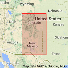
- Estancia basin
Summary:
Named for Placer Mountains, about 30 mi south of Santa Fe in the Estancia basin of NM. Composed of coal beds. Underlies Gallisteo sands. Has fossil deciduous leaves. Is of early Tertiary age.
Source: GNU records (USGS DDS-6; Denver GNULEX).
For more information, please contact Nancy Stamm, Geologic Names Committee Secretary.
Asterisk (*) indicates published by U.S. Geological Survey authors.
"No current usage" (†) implies that a name has been abandoned or has fallen into disuse. Former usage and, if known, replacement name given in parentheses ( ).
Slash (/) indicates name conflicts with nomenclatural guidelines (CSN, 1933; ACSN, 1961, 1970; NACSN, 1983, 2005, 2021). May be explained within brackets ([ ]).