The National Geologic Map Database is migrating to a new infrastructure. We apologize for any service disruptions during this process.
|
|---|


- Usage in publication:
-
- Pitkin Limestone
- Modifications:
-
- Revised
- AAPG geologic province:
-
- Arkoma basin
- Ozark uplift
Summary:
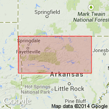
Considered in this report to be a fossil-fragmental and oolitic calcarenite. Has minor amount of calcilutite and thin black shale. Generally massive bedded. Forms prominent bluffs. Overlies Fayetteville Shale conformably or transitionally (east), and disconformably (west). Underlies the newly named Wallace Creek Shale Member of Marcella Formation (new). Isopach and lithofacies map; present over large part of northern AR mostly in Arkoma basin; extends into southern Boone Co, AR on the Ozark uplift. Pitkin thickens southward to 200 ft. Rocks assigned to Marcella were considered part of Pitkin in earlier reports. Limestones in the two formations differ--those in the Marcella commonly have 1 to 2 percent quartz sand and locally more than 50 percent quartz sand. The Pitkin has no quartz sand. Nomenclature chart. Cross section. Of Late Mississippian, Chester age.
Source: GNU records (USGS DDS-6; Denver GNULEX).
- Usage in publication:
-
- Pitkin Limestone*
- Modifications:
-
- Areal extent
- AAPG geologic province:
-
- Arkoma basin
- Chautauqua platform
Summary:
Unconformably underlies Morrowan rocks throughout report area. In Washington Co, AR and west to central Adair Co, OK in the Arkoma basin, Pitkin unconformably underlies the Hale Formation. West of central Adair and Cherokee Cos, OK into Cherokee and Muskogee Cos on the Chautauqua platform, Pitkin unconformably underlies the newly named Braggs Member of the also newly named Sausbee Formation. Pitkin is easily distinguished from the Morrowan rocks by its low percentage of quartz sandstone, its light gray to brown color, and its abundance of ARCHIMEDES. Most of the formation is an oolitic grainstone with a few beds of poorly winnowed micritic oolitic grainstone and packstone. Of Late Mississippian age. Cross section. Stratigraphic chart.
Source: GNU records (USGS DDS-6; Denver GNULEX).
For more information, please contact Nancy Stamm, Geologic Names Committee Secretary.
Asterisk (*) indicates published by U.S. Geological Survey authors.
"No current usage" (†) implies that a name has been abandoned or has fallen into disuse. Former usage and, if known, replacement name given in parentheses ( ).
Slash (/) indicates name conflicts with nomenclatural guidelines (CSN, 1933; ACSN, 1961, 1970; NACSN, 1983, 2005, 2021). May be explained within brackets ([ ]).