

- Usage in publication:
-
- Pipestone Canyon formation
- Modifications:
-
- Named
- Dominant lithology:
-
- Conglomerate
- Siltstone
- Sandstone
- Shale
- AAPG geologic province:
-
- Northern Cascade Range-Okanagan province
Summary:
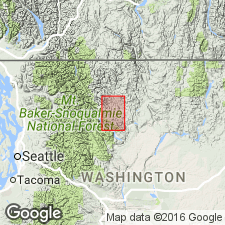
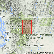
Named for exposures in Pipestone Canyon approximately 5 mi northeast of Twisp [Blue Buck Mountain] Okanogan Co, WA, which is designated type locality. Consists mainly of arkosic sandstone and interbedded siltstone with conglomerate at base and shale in upper part. Thickness is 2300 ft at type locality. Unconformably overlies Midnight Peak formation (new) of Late Cretaceous age. [no overlying rocks given] Assigned Tertiary(?) age on basis of stratigraphic relations.
Source: GNU records (USGS DDS-6; Menlo GNULEX).
- Usage in publication:
-
- Pipestone Canyon formation
- Modifications:
-
- Age modified
- Biostratigraphic dating
- AAPG geologic province:
-
- Cascades province
- Okanogan province
Summary:
Extensive collection of plant fossils made from "middle beds" at type locality. It is concluded that most probable age is Paleocene.
Source: GNU records (USGS DDS-6; Menlo GNULEX).
- Usage in publication:
-
- Pipestone Canyon Formation
- Modifications:
-
- Overview
- AAPG geologic province:
-
- Cascades province
- Okanogan province
Summary:
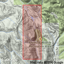
Measured type section (2313 ft thick) designated as exposures in secs.15,22,27 T34N R22E, Pipestone Canyon, 5 mi northeast of Twisp [Blue Buck Mountain] Okanogan Co, WA. Stratigraphic and paleontologic sections and geologic map included in this overview paper.
Source: GNU records (USGS DDS-6; Menlo GNULEX).
For more information, please contact Nancy Stamm, Geologic Names Committee Secretary.
Asterisk (*) indicates published by U.S. Geological Survey authors.
"No current usage" (†) implies that a name has been abandoned or has fallen into disuse. Former usage and, if known, replacement name given in parentheses ( ).
Slash (/) indicates name conflicts with nomenclatural guidelines (CSN, 1933; ACSN, 1961, 1970; NACSN, 1983, 2005, 2021). May be explained within brackets ([ ]).