

- Usage in publication:
-
- Piper formation*
- Modifications:
-
- Named
- Dominant lithology:
-
- Redbeds
- Shale
- Gypsum
- Limestone
- Dolomite
- AAPG geologic province:
-
- Central Montana uplift
- Williston basin
Summary:
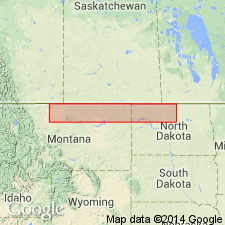
Named as formation in Ellis group for town of Piper, about 1 mi southwest of Piper sec 17, T14N, R20E, Fergus Co, MT, its type section on Central Montana uplift. Includes red beds, gypsum, and associated normal marine beds beneath Rierdon formation in eastern MT east of Sweetgrass-Big Belt line of uplift. Basal part locally includes equivalents of type Gypsum Spring formation of central WY of Love (1945); upper part includes beds placed in lower part, lower Sundance formation in Wind River basin. In MT, consists of lower red bed and gypsum; middle gray shale, limestone, and dolomite; and upper red bed and gypsum members which grade into each other vertically and laterally (see figures). At type consists of (ascending) 12 ft massive white gypsum, 6 ft brittle, chocolate-gray limestone, 57 ft maroon and green siltstone and shale, 5 ft gray silty limestone, 9 ft gray, papery to chunky shale, and 4 ft yellowish-gray sandy limestone. Thickness ranges from 0 to nearly 300 ft and varies considerably within short distances. Unconformably overlies Triassic or older rocks; conformably overlain by Rierdon. Grades laterally into Sawtooth formation in western MT. Assigned to Middle Jurassic (Bajocian and Bathonian) based on sparse fossils (ammonites and gastropods) and on stratigraphic relations with better dated Sawtooth. Distribution, correlation, and lithologic variations in central and southwestern MT shown on figures.
Source: GNU records (USGS DDS-6; Denver GNULEX).
- Usage in publication:
-
- Piper formation*
- Modifications:
-
- Areal extent
- AAPG geologic province:
-
- Montana folded belt
- Williston basin
- Powder River basin
- Central Montana uplift
- Bighorn basin
- Sweetgrass arch
Summary:
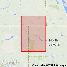
Shows regional correlation. Name extended into the subsurface of eastern MT and western ND. Name used for rocks of Middle Jurassic age beneath Rierdon or Sundance formations. Middle Jurassic (Bajocian and Bathonian) in age. A formation in Ellis group.
Source: GNU records (USGS DDS-6; Denver GNULEX).
- Usage in publication:
-
- Piper unit
- Modifications:
-
- Overview
- AAPG geologic province:
-
- Williston basin
- Powder River basin
- Central Montana uplift
- Sweetgrass arch
- Bighorn basin
- Wind River basin
- Montana folded belt
Summary:
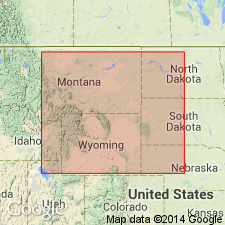
Defined as Piper formation of central MT; Sawtooth formation in western MT, Gypsum Spring formation in WY and eastern SD, lower part of Twin Creek limestone (members B, C, and D) in eastern ID and western WY, lower part of Sundance formation in southern Saskatchewan, Manitoba, and ND. Shows correlation, thickness, and lithofacies, and makes tectonic and environmental interpretations. Middle Jurassic (Bajocian and Bathonian) in age. Underlain unconformably by Early Jurassic or older rocks; overlain conformably at most places by Rierdon unit.
Source: GNU records (USGS DDS-6; Denver GNULEX).
- Usage in publication:
-
- Piper formation
- Modifications:
-
- Revised
- Areal extent
- Overview
- AAPG geologic province:
-
- Williston basin
Summary:
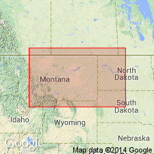
Is basal formation of Ellis group in eastern MT and ND in Williston basin. A thick limestone at top is the best marker bed in the Jurassic. Appears to downgrade into the Triassic Spearfish formation below. Overlain by Rierdon formation in eastern MT and by Sundance in ND. Shows representative sections.
Source: GNU records (USGS DDS-6; Denver GNULEX).
- Usage in publication:
-
- Piper formation
- Modifications:
-
- Revised
- AAPG geologic province:
-
- Williston basin
Summary:
Subdivided to include (ascending) Tampico shale, Firemoon limestone, and Bowes members (all new), These units are recognized in subsurface and surface sections. In subsurface in Williston basin overlies Kline member of Nesson formation (new) of possible Early Jurassic age. Overlaps Nesson formation toward the basin margins. Overlain by Rierdon formation. West of Bowdoin dome, Piper lies unconformably on Madison limestone. In central and south-central MT it lies on beds ranging from Upper Mississippian through Triassic. Is Middle Jurassic in age.
Source: GNU records (USGS DDS-6; Denver GNULEX).
- Usage in publication:
-
- Piper formation
- Modifications:
-
- Areal extent
- Revised
- Overview
- AAPG geologic province:
-
- Williston basin
Summary:
Can be traced over western half of Williston basin. Can be divided into three members. Lower member normal marine limestones, sandstones, and calcareous shales, characterized by rapid facies changes. Middle member is limestone, locally known as "Piper limestone". Upper member is early limestone at top underlain by greenish-gray shale. All three members grade into sandstone in eastern part of the area where the formation is included as part of an undifferentiated Sundance formation. The true "Piper limestone" of MT lies stratigraphically higher than the so-called "Piper limestone" of ND, which forms the top of Gypsum Spring formation. Underlain by Gypsum Spring formation, overlain by Rierdon formation. Middle Jurassic in age. [Additional details given in Francis, D. R., 1957, American Association of Petroleum Geologists Bulletin, v. 41, no. 3, p. 379 (table 1), 382, 385 (fig. 9), 386].
Source: GNU records (USGS DDS-6; Denver GNULEX).
- Usage in publication:
-
- Piper formation
- Modifications:
-
- Overview
- Revised
- AAPG geologic province:
-
- Central Montana uplift
- Powder River basin
- Williston basin
- Sweetgrass arch
Summary:
Divided into three regional units of member rank called (ascending): Piper "A", "B", and "C" for a lower red bed and gypsum member, a middle carbonate and green or gray shale member, and an upper red bed member, respectively. The three units are described and correlated in well and surface sections in western ND, northwestern SD, northeastern WY, and eastern and central MT in Williston basin, northern Powder River basin, Central Montana uplift, and eastern Sweetgrass arch. At Spearfish, Lawrence Co, SD Piper "A" is represented by Gypsum Spring formation, and Piper "B" and "C" are missing by erosion at base of Sundance formation. Discusses paleogeography and the depositional environments of the units and their equivalents in the northern Rocky Mountains and Great Plains. Reviews basis for dating. Is lowest formation of Ellis Group. Middle Jurassic (Bathonian and Bajocian) in age. Includes isopach map and correlation diagrams.
Source: GNU records (USGS DDS-6; Denver GNULEX).
- Usage in publication:
-
- Piper formation
- Modifications:
-
- Revised
- Overview
- AAPG geologic province:
-
- Williston basin
Summary:
In the Williston basin where the marine Jurassic succession is considered to be more complete than in adjacent areas, the Middle Jurassic (as understood by Imlay) is composed of five distinct stratigraphic units which constitute Sawtooth and Gypsum Spring depositional sequences. These sequences occur above a red bed interval of uncertain age and below Rierdon formation of Upper Jurassic age. Sawtooth sequence comprises the upper two stratigraphic units which correspond to type Sawtooth formation of Sweetgrass arch. Gypsum Spring sequence consists of the lower three Middle Jurassic stratigraphic units which correspond to Piper or Gypsum Spring formations as designated by Imlay (1948) near Heath in central MT and in Williston basin. On the basis of this relationship, and of the evidence for progressive onlap and overlap from Williston basin to Sweetgrass arch by the Middle Jurassic stratigraphic units, Sawtooth formation of western MT is considered to be younger than Gypsum Spring (or Piper) formation of central MT. This interpretation differs from the more general belief that Sawtooth and Piper are contemporaneous. Correlates Piper (or Gypsum Spring) with Nesson formation and overlying Tampico shale member of Piper formation of Nordquist (1955), and with Gypsum Spring and overlying lower part of Piper formation of Francis (1957.
Source: GNU records (USGS DDS-6; Denver GNULEX).
- Usage in publication:
-
- Piper Formation
- Modifications:
-
- Revised
- AAPG geologic province:
-
- Williston basin
Summary:
The term Nesson Formation should be abandoned [in ND] and the term Piper Formation used in its place. Because the term Poe Member [of Nesson Formation] is useful in describing the lower evaporite unit, it will be referred to as Poe Member of Piper Formation. The name Dunham Salt (of Zieglar, 1955) is used to identify a basal salt unit in the Poe Member [and is referred to as the Dunham beds]. Is Jurassic in age.
Source: GNU records (USGS DDS-6; Denver GNULEX).
- Usage in publication:
-
- Piper Formation
- Modifications:
-
- Redescribed
- Revised
- AAPG geologic province:
-
- Williston basin
Summary:
Includes (ascending): Dunham Salt, Poe, Picard, Kline, Tampico, Firemoon, and Bowes Members. Overlain by Rierdon Formation; underlain by Spearfish Formation. Jurassic in age. [Name Nesson Formation, which underlies Piper Formation in eastern MT, and which includes (ascending), Poe Evaporite, Picard, and Kline Members, not used in western ND by the ND Geological Society.] Is Jurassic in age.
Source: GNU records (USGS DDS-6; Denver GNULEX).

- Usage in publication:
-
- Piper Formation*
- Modifications:
-
- Overview
- AAPG geologic province:
-
- Williston basin
- Central Montana uplift
- Sweetgrass arch
- Montana folded belt
- Bighorn basin
Summary:
Divided in the subsurface in northeastern MT and southwestern MT into (ascending): Tampico Shale (Bajocian), Firemoon Limestone (Bajocian), and Bowes (Bathonian) Members of Nordquist (1955), all herein adopted for USGS usage. Includes (ascending) Firemoon Limestone and Bowes Members on the Porcupine Dome, eastern MT. Overlain by Rierdon Formation; underlain in the deeper part of Williston basin by Nesson Formation. Middle Jurassic (Bajocian and Bathonian) in age. Summarizes lithology, basis for dating, distribution, and correlation.
Source: GNU records (USGS DDS-6; Denver GNULEX).
- Usage in publication:
-
- Piper Formation
- Modifications:
-
- Revised
- AAPG geologic province:
-
- Williston basin
Summary:
Excludes Dunham Salt from Piper Formation in the ND part of Williston basin. Overlies Dunham Salt conformably; underlies Rierdon Formation conformably in the central part of Williston basin, including the Nesson anticline, and unconformably to the east and south in ND. Middle Jurassic (Bajocian and Bathonian) in age.
Source: GNU records (USGS DDS-6; Denver GNULEX).
For more information, please contact Nancy Stamm, Geologic Names Committee Secretary.
Asterisk (*) indicates published by U.S. Geological Survey authors.
"No current usage" (†) implies that a name has been abandoned or has fallen into disuse. Former usage and, if known, replacement name given in parentheses ( ).
Slash (/) indicates name conflicts with nomenclatural guidelines (CSN, 1933; ACSN, 1961, 1970; NACSN, 1983, 2005, 2021). May be explained within brackets ([ ]).