- Usage in publication:
-
- Pioneer sandstone
- Modifications:
-
- Original reference
- Dominant lithology:
-
- Sandstone
- AAPG geologic province:
-
- Appalachian basin
Summary:
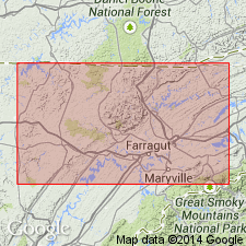
Pg. 18-19, 21, 22. Pioneer sandstone. Recognized in Northern Tennessee coal field. A massive sandstone that in many places outcrops in prominent cliffs and usually has a broad bench just above it. In Briceville region this sandstone is very prominent and the bench immediately above it is known locally as Brayden Bench. The sandstone is believed to be same as the sandstone in gap at Old Pioneer, in Campbell County, Tennessee, and has been called by writer Pioneer sandstone. It forms topmost member of Jellico formation. In some places, as near Briceville and southwestward toward Windrock, the Pioneer sandstone at the base [of Scott formation] is prominent and forms Brayden Bench, and over it there is another prominent sandstone in lower part of the [Scott] formation that forms Dougherty Bench. [On p. 32 is statement that Pioneer sandstone is basal member of Scott formation, and on p. 51 is statement that west of Briceville the Pioneer sandstones form the Dougherty Bench. On p. 316 is following statement: Where it [the Pioneer sandstone] is in average development it forms projecting cliffs and underlies a bench that about Petros is prominently developed and known as Dougherty Bench. About Briceville, in Anderson County, the corresponding bench is known as Brayden Bench and another bench 200 to 225 feet higher is there locally known as Dougherty Bench. Writer evidently intended to make his Pioneer sandstone the top member of his Jellico formation.] Age is Pennsylvanian.
Source: US geologic names lexicon (USGS Bull. 896, p. 1669).

- Usage in publication:
-
- Pioneer sandstone
- Modifications:
-
- Revised
- AAPG geologic province:
-
- Appalachian basin
Summary:
Pg. 6, 19, pls. 2, 3, 4. Pioneer sandstone of Indian Bluff group. Assigned to Indian Bluff group (new). [Jellico formation discarded.] Top of sandstone forms Poteet Gap, where it is about 55 feet thick; in Cross Mountain section 50 to 60 feet thick; in Petros section 4 feet. Separated from underlying Indian Fork sandstone (new) by shale interval that is as much as 80 feet thick in some places; separated from overlying Armes Gap sandstone (new) of Graves Gap group (new) by a shale interval that contains the Jordan coal and Norman Pond coal.
Source: US geologic names lexicon (USGS Bull. 1200, p. 3044-3045).

- Usage in publication:
-
- Pioneer Sandstone Member
- Modifications:
-
- [Revised]
- Areal extent
- AAPG geologic province:
-
- Appalachian basin
Summary:
(East-central and East sheets; not separately mapped.) Pioneer Sandstone Member of Indian Bluff Formation. At top of Indian Bluff Formation; underlies Graves Gap Formation. Age is Pennsylvanian.
[The Indian Bluff Group of Wilson and others (1956) is reduced to formation rank. Its constituent formations, the Pioneer, Indian Fork, Stockstill, and Seeber Flats, are also reduced in rank to members (only the Pioneer is incl. on State geol. map). See also under Graves Gap.]
Source: Publication.
For more information, please contact Nancy Stamm, Geologic Names Committee Secretary.
Asterisk (*) indicates published by U.S. Geological Survey authors.
"No current usage" (†) implies that a name has been abandoned or has fallen into disuse. Former usage and, if known, replacement name given in parentheses ( ).
Slash (/) indicates name conflicts with nomenclatural guidelines (CSN, 1933; ACSN, 1961, 1970; NACSN, 1983, 2005, 2021). May be explained within brackets ([ ]).

