

- Usage in publication:
-
- Pinto gneiss
- Modifications:
-
- Named
- Dominant lithology:
-
- Gneiss
- AAPG geologic province:
-
- Transverse Ranges province
Summary:
Named for Pinto Mtns., Twenty-Nine Palms area, Riverside and San Bernardino Cos., CA. Comprises a complex of rocks, metamorphic facies of Gold-Park Gabbro-Diorite (new) and Palms Granite (new) and pegmatitic granite together with metasediments. Commonly consists of dark-gray to nearly black bands of metagabbro-diorite and light-gray to pinkish gray bands of granitic material. Intruded by White Tank Monzonite (new) of Jurassic(?) age. Assigned Precambrian ("or more than likely early" Precambrian) age based on studies (Miller, 1934) of similar rocks in San Gabriel Mtns.
Source: GNU records (USGS DDS-6; Menlo GNULEX).
- Usage in publication:
-
- Pinto gneiss
- Modifications:
-
- Age modified
- AAPG geologic province:
-
- Transverse Ranges province
Summary:
Is [lithologically] correlative with Chuckwalla Complex of Palm Springs-Blythe area. Believed to be early Precambrian age (Miller, 1938, p. 438).
Source: GNU records (USGS DDS-6; Menlo GNULEX).
- Usage in publication:
-
- Pinto gneiss
- Modifications:
-
- Mapped
- AAPG geologic province:
-
- Transverse Ranges province
Summary:
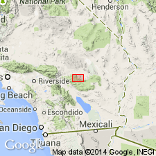
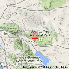
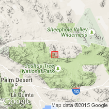
Mapped in Twentynine Palms area of Joshua Tree National Monument. Probably intruded by Gold Park Gabbro-Diorite (or Gold Park Gabbro-Diorite intruded sediments from which Pinto Gneiss was derived). Definitely intruded by Palms quartz monzonite (Palms Granite of Miller, 1938).
Source: GNU records (USGS DDS-6; Menlo GNULEX).
- Usage in publication:
-
- Pinto gneiss
- Modifications:
-
- Areal extent
- AAPG geologic province:
-
- Transverse Ranges province
Summary:
Extended into and mapped in detail in western portion of Joshua Tree National Monument, Riverside and San Bernardino Counties, California. Is correlative with Berdoo series (McClellan, 1936) and Chuckwalla complex (Miller, 1944).
Source: Modified from GNU records (USGS DDS-6; Menlo GNULEX).
- Usage in publication:
-
- Pinto gneiss
- Modifications:
-
- Areal extent
- AAPG geologic province:
-
- Transverse Ranges province
Summary:
Extended into and mapped in southern Music Valley area, Riverside Co., CA. Contains U-Thor deposit. Is oldest rock exposed. Intruded by Palms Granite and Gold Park Gabbro-Diorite. Considered to be Precambrian age.
Source: GNU records (USGS DDS-6; Menlo GNULEX).
- Usage in publication:
-
- Pinto Gneiss
- Modifications:
-
- Age modified
- AAPG geologic province:
-
- Transverse Ranges province
Summary:
Age of augen gneiss is about 1650 Ma (Silver, 1971) and retrograded granulitic gneiss is about 1400 Ma (Silver and others, 1963; Silver, 1971) based on U-Pb decay constants of Jaffey and others, 1971. [p.120-121] [Middle Proterozoic]
Source: GNU records (USGS DDS-6; Menlo GNULEX).
- Usage in publication:
-
- Pinto Gneiss
- Modifications:
-
- Mapped
- AAPG geologic province:
-
- Transverse Ranges province
Summary:
Mapped in Joshua Tree National Monument.
Source: GNU records (USGS DDS-6; Menlo GNULEX).
For more information, please contact Nancy Stamm, Geologic Names Committee Secretary.
Asterisk (*) indicates published by U.S. Geological Survey authors.
"No current usage" (†) implies that a name has been abandoned or has fallen into disuse. Former usage and, if known, replacement name given in parentheses ( ).
Slash (/) indicates name conflicts with nomenclatural guidelines (CSN, 1933; ACSN, 1961, 1970; NACSN, 1983, 2005, 2021). May be explained within brackets ([ ]).