The National Geologic Map Database is migrating to a new infrastructure. We apologize for any service disruptions during this process.
|
|---|


- Usage in publication:
-
- Pinnick coal member
- Modifications:
-
- Original reference
- Dominant lithology:
-
- Coal
- AAPG geologic province:
-
- Illinois basin
Summary:
Pg. 26-27. Pinnick coal member of Mansfield formation. Important stratigraphic marker or key bed at top of lower unit of Mansfield. Average thickness about 1 foot. Coal named by D.W. Franklin (1939, unpub. thesis). Franklin's type section no longer exposed. Other good exposures noted. Age is Pennsylvanian.
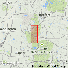
Type section (of Franklin, 1939): mine on Pinnick property, in SE/4 SW/4 sec. 32, T. 2 N., R. 2 W., Orange Co., south-central IN.
Source: US geologic names lexicon (USGS Bull. 1200, p. 3039).

- Usage in publication:
-
- Pinnick Coal Member
- Modifications:
-
- Overview
- AAPG geologic province:
-
- Illinois basin
Summary:
Pg. 113, pls. Pinnick Coal Member of Mansfield Formation of Raccoon Creek Group. Shiny, blocky coal. Thickness 2.1 feet (0.6 m); generally less than 1 foot (0.3 m) thick. Roof is carbonaceous shale or massive medium-grained ferruginous sandstone; floor is underclay. Lies immediately above so-called Hindostan Whetstone Beds, about 50 to 185 feet (15 to 56 m) above base of Mansfield. Present in Orange, Dubois, and Martin Counties, south-central Indiana. Age is Early Pennsylvanian (Morrowan). Report includes map of type sections-localities-areas, correlation chart.
Source: Publication.
For more information, please contact Nancy Stamm, Geologic Names Committee Secretary.
Asterisk (*) indicates published by U.S. Geological Survey authors.
"No current usage" (†) implies that a name has been abandoned or has fallen into disuse. Former usage and, if known, replacement name given in parentheses ( ).
Slash (/) indicates name conflicts with nomenclatural guidelines (CSN, 1933; ACSN, 1961, 1970; NACSN, 1983, 2005, 2021). May be explained within brackets ([ ]).