

- Usage in publication:
-
- Pinkerton Trail formation
- Modifications:
-
- Named
- Dominant lithology:
-
- Limestone
- Shale
- AAPG geologic province:
-
- San Juan basin
Summary:
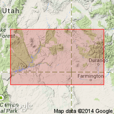
Named for exposures (its type locality) on Pinkerton Trail near the D&RG Railway tracks about 12 mi north of Durango, La Plata Co, CO in the San Juan basin. Overlies Molas shale and underlies Paradox formation (raised in stratigraphic rank). Shown on cross section as present in the San Juan of southwest CO and northwest NM, and in the Paradox basin of southwest CO and eastern UT. Wedges westward and southward from the Paradox salt basin. Consists [only a general description given] of dark-gray, fine to coarsely crystalline, crinoidal, and fusulinid-bearing limestone and some dark-gray shale. Ranges in thickness from a wedge-edge to 200+ ft thick. Cross sections. Assigned to the Atoka and Des Moines Series. Correlation chart.
Source: GNU records (USGS DDS-6; Denver GNULEX).
- Usage in publication:
-
- Pinkerton Trail formation
- Modifications:
-
- Revised
- Areal extent
- Overview
- AAPG geologic province:
-
- Paradox basin
- San Juan basin
- Black Mesa basin
Summary:
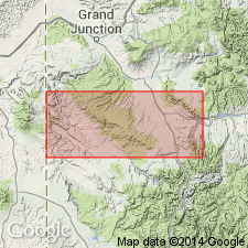
Revised in that the lower 0-175 ft removed from Pinkerton Trail formation of the Hermosa group and reassigned to the newly named Lime Ridge formation of the Hermosa. Lime Ridge occurs as a narrow band on the shelf rim of the salt basin. Pinkerton Trail extends (isopach map) from the Durango, CO and Farmington, NM areas of the San Juan basin, west across northern Apache and Navajo Cos, AZ, Black Mesa basin, north in Montezuma, Dolores, and San Miguel Cos, CO, west to San Juan, Garfield, Wayne, and Emery Cos, UT in the Paradox basin. Underlies Paradox formation of Hermosa. Nomenclature chart. Of Pennsylvanian age. Is a marine unit with reef deposits (reef trend map). Discussion of depositional history.
Source: GNU records (USGS DDS-6; Denver GNULEX).
- Usage in publication:
-
- Pinkerton Trail formation
- Modifications:
-
- Revised
- AAPG geologic province:
-
- Paradox basin
- Black Mesa basin
- San Juan basin
Summary:
Shown on figure as basal formation of Hermosa group [rank raised but intent to raise rank not stated] in Paradox basin, southeast UT. Formation name extended into northwest part of San Juan basin, NM and to Black Mesa basin, AZ, but use of Hermosa group in these two basins not clearly shown on figure 3. Overlies Molas formation; underlies Paradox formation. Is composed of gray, fine- to medium-crystalline fossiliferous limestone interbedded with and underlain by dark to light gray silty shale. Limestone conglomerates locally. Up to 195 ft thick in Paradox basin. Wedges out southwestward, grades into lower part of Sandia formation southeastward in San Juan basin. Fossils range from Atokan to earliest Desmoinesian, or Middle Pennsylvanian. Correlates with part of Oquirrh, Sandia, Naco, and Belden formations. Many cross sections. Correlation chart.
Source: GNU records (USGS DDS-6; Denver GNULEX).
- Usage in publication:
-
- Pinkerton Trail Formation
- Modifications:
-
- Reference
- Revised
- AAPG geologic province:
-
- Paradox basin
- Black Mesa basin
- San Juan basin
Summary:
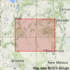
At original type section, contact with underlying Molas Formation is covered and top of Pinkerton Trail of Hermosa Group is at top of fossiliferous limestone below 800 ft of clastic rocks which, in turn, underlie evaporites of Paradox Formation of Hermosa. In subsurface, clastics are missing due to wedge-out, thus upper contact of Pinkerton Trail has been determined arbitrarily. Top of Pinkerton Trail in this report is at base of lowest evaporite which can be recognized in outcrop and subsurface. (Clastic rocks between Paradox and Pinkerton Trail have local distribution and perhaps should be assigned to separate formation). [Clastic rocks are presumably an unnamed and unranked part of Hermosa.] Study area is Four Corners area of CO, UT, NM, and AZ within Paradox, San Juan, and Black Mesa basins. Alternate "subsurface type section" [reference section] is designated in Shell No. 1 Bluff well in sec 32, T39S, R23E, San Juan Co, UT, Paradox basin. Interval was cored and sample and mechanical well logs are available. In No. 1 Bluff well, Pinkerton Trail is 100 ft thick. [No interval or description provided.] Unit shown as consisting of carbonates in diagrammatic cross section (fig. 2). Revised unit ranges up to 500-600 ft thick. Equivalent to "lower Hermosa" of previous usage. Conformably overlies Molas Formation; conformably and gradationally underlies Paradox. Stratigraphic chart. Atokan and Desmoinesian (Pennsylvanian) age.
Source: GNU records (USGS DDS-6; Denver GNULEX).
- Usage in publication:
-
- Pinkerton Trail Formation*
- Modifications:
-
- Areal extent
- AAPG geologic province:
-
- San Juan basin
- Black Mesa basin
- Paradox basin
Summary:
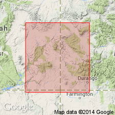
An isopach map shows thickness of Pinkerton Trail Formation (lower formation of Hermosa Group) and its correlative to the southeast, the Sandia Formation. The arbitrary geographic limit between the two formations is in northwest Sandoval and adjoining McKinley Co., NM where there is a constriction in the depositional sites. Sandia thickens to southeast to more than 80 ft thick. Pinkerton Trail thickens to northwest from the San Juan basin into the Black Mesa basin of AZ and the Paradox basin of southwest CO and southeast UT to more than 120 ft. Pinkerton Trail overlies Molas Formation and underlies Paradox Formation (of Hermosa Group). Sandia unconformably overlies Log Springs Formation and underlies Madera Limestone. Correlation chart. Pennsylvanian age.
Source: GNU records (USGS DDS-6; Denver GNULEX).
For more information, please contact Nancy Stamm, Geologic Names Committee Secretary.
Asterisk (*) indicates published by U.S. Geological Survey authors.
"No current usage" (†) implies that a name has been abandoned or has fallen into disuse. Former usage and, if known, replacement name given in parentheses ( ).
Slash (/) indicates name conflicts with nomenclatural guidelines (CSN, 1933; ACSN, 1961, 1970; NACSN, 1983, 2005, 2021). May be explained within brackets ([ ]).