The National Geologic Map Database is migrating to a new infrastructure. We apologize for any service disruptions during this process.
|
|---|


- Usage in publication:
-
- Piney Point formation*
- Modifications:
-
- Named
- Dominant lithology:
-
- Sand
- AAPG geologic province:
-
- Atlantic Coast basin
Summary:
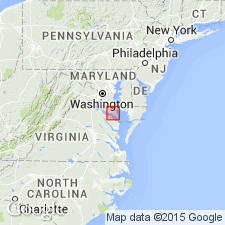
Piney Point Formation is new name applied to glauconitic sands and interspersed shell beds of Jackson age that lie above Nanjemoy formation and below Calvert formation with conformable contacts. Occurs as a wedge shaped unit. Attains maximum thickness of 60 ft in wells near Lexington Park and Breton Beach, MD. Present in southern MD southeast of a line extending southwestward from Kenwood Beach across Calvert and St. Marys Cos. to vicinity of Cobb Island in Charles Co.; recognizable in Northumberland and Westmoreland Cos., VA. Age is late Eocene.
Source: GNU records (USGS DDS-6; Reston GNULEX).
- Usage in publication:
-
- Piney Point formation*
- Modifications:
-
- Areal extent
- AAPG geologic province:
-
- Atlantic Coast basin
Summary:
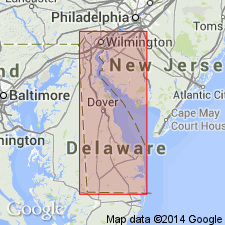
Piney Point formation accepted for DE from Dover, southward.
Source: GNU records (USGS DDS-6; Reston GNULEX).
- Usage in publication:
-
- Piney Point Formation*
- Modifications:
-
- Areal extent
- AAPG geologic province:
-
- Atlantic Coast basin
Summary:
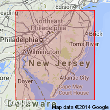
Marine sediments of late Eocene age that are correlative with the Jackson Group of the Gulf Coast have been recognized in the subsurface of southern NJ. Rasmussen gave the name Piney Point Formation to the sediments of Jackson age penetrated by a deep well at Atlantic City, NJ.
Source: GNU records (USGS DDS-6; Reston GNULEX).
- Usage in publication:
-
- Piney Point Formation*
- Modifications:
-
- Revised
- Age modified
- Reference
- AAPG geologic province:
-
- Atlantic Coast basin
Summary:
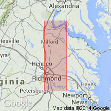
Piney Point Formation is here assigned to the Pamunkey Group in the study area. Age is modified from upper to middle Eocene as Brown, Miller, and Swain (1972) listed a number of species of ostracodes and foraminifers from the type section that clearly show the age to be middle Eocene. A reference section is established along the Pamunkey River in VA. Unit consists of three informal beds (A, B, C) composed of clayey, poorly sorted very glauconitic, highly fossiliferous sand. The lithologic section is more than 28 ft thick and consists of many small exposures along the Pamunkey River from above the Rte 360 bridge to below the locale of Retreat; the exposures include the 15-ft thick Bed B in the reference section.
Source: GNU records (USGS DDS-6; Reston GNULEX).
- Usage in publication:
-
- Piney Point Formation*
- Modifications:
-
- Areal extent
- AAPG geologic province:
-
- Atlantic Coast basin
Summary:
Use of the term Piney Point Formation in NJ is discontinued in this report. Strata are assigned to the middle Eocene Shark River Formation.
Source: GNU records (USGS DDS-6; Reston GNULEX).

- Usage in publication:
-
- Piney Point Formation
- Modifications:
-
- Overview
- AAPG geologic province:
-
- Atlantic Coast basin
Summary:
Undifferentiated Pamunkey Group, Old Church Formation, and unnamed glauconitic sands are lumped as lower Tertiary deposits on the State map. Individual units are discussed in the text. Piney Point Formation of Pamunkey Group is described as olive-gray and grayish-olive-green, glauconitic quartz sand, medium- to coarse-grained, and poorly sorted. Contains scattered quartz pebbles, interbedded with carbonate-cemented sand and moldic limestone. Unit is characterized by large, calcitic shells of the oyster CUBITOSTREA SELLAEFORMIS, a middle Eocene marker. Aragonitic mollusks are generally leached, leaving only molds and casts. Thickness is 0 to 60 ft.
Source: GNU records (USGS DDS-6; Reston GNULEX).
For more information, please contact Nancy Stamm, Geologic Names Committee Secretary.
Asterisk (*) indicates published by U.S. Geological Survey authors.
"No current usage" (†) implies that a name has been abandoned or has fallen into disuse. Former usage and, if known, replacement name given in parentheses ( ).
Slash (/) indicates name conflicts with nomenclatural guidelines (CSN, 1933; ACSN, 1961, 1970; NACSN, 1983, 2005, 2021). May be explained within brackets ([ ]).