The National Geologic Map Database is migrating to a new infrastructure. We apologize for any service disruptions during this process.
|
|---|


- Usage in publication:
-
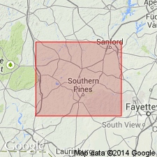
- Pinehurst formation
- Modifications:
-
- Named
- Dominant lithology:
-
- Sand
- Gravel
- AAPG geologic province:
-
- Atlantic Coast basin
Summary:
Named for town of Pinehurst, Moore Co., south-central NC. Applies to so-called high-level gravels. In Moore Co., consists of nonfossiliferous sand and gravel which caps all of higher Coastal Plain hills in central and western part of the county. Exposed on top of high hill at Carthage at elevation of over 500 ft; slopes from there to the southeast until elevation of 350 ft in southern part of county. Gravels on hill at Carthage range from 3 to 7 ft thick and consist of brown, coarse, iron-stained sand containing lenses of quartz pebbles. Thickens downdip to over 150 ft in southern part of county. Bedding and composition rapidly change from coarse sand with pebble beds and lenses to festooned cross-bedded sands and fine gravels downdip. Unconformably overlies Tuscaloosa formation in undulating contact. Age is late Miocene.
Source: GNU records (USGS DDS-6; Reston GNULEX).
- Usage in publication:
-
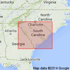
- Pinehurst Formation
- Modifications:
-
- Overview
- Areal extent
- AAPG geologic province:
-
- Atlantic Coast basin
Summary:
Term Pinehurst Formation, as redefined by Bartlett (1967), is applied to steeply cross-bedded windblown deposits erratically distributed across the SC upper Coastal Plain. Sands are generally light tan, loose with no interstitial clay, commonly poorly sorted, and fine- to very coarse grained with granules. Dark brown clayey zones indicated interdune pond deposits. Deposits occur in a belt about 16 km wide extending from near Foxtown, northern Aiken Co., to the vicinity of Southern Pines, NC. Thickness is variable, ranging from a feather edge to 30 m. Formation may locally overlie Cretaceous, lower middle Eocene, upper Eocene, or middle Miocene(?) stratigraphic units. Age assignment of late Miocene to early Pliocene based on stratigraphic position below the Duplin Formation and above the middle Miocene upland unit.
Source: GNU records (USGS DDS-6; Reston GNULEX).
For more information, please contact Nancy Stamm, Geologic Names Committee Secretary.
Asterisk (*) indicates published by U.S. Geological Survey authors.
"No current usage" (†) implies that a name has been abandoned or has fallen into disuse. Former usage and, if known, replacement name given in parentheses ( ).
Slash (/) indicates name conflicts with nomenclatural guidelines (CSN, 1933; ACSN, 1961, 1970; NACSN, 1983, 2005, 2021). May be explained within brackets ([ ]).