The National Geologic Map Database is migrating to a new infrastructure. We apologize for any service disruptions during this process.
|
|---|


- Usage in publication:
-
- Pine Valley latite
- Modifications:
-
- Named
- Dominant lithology:
-
- Latite
- Porphyry
- AAPG geologic province:
-
- Great Basin province
Summary:
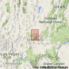
Mapped in northern part of Pine Valley Mountains, for which unit was probably named, Washington and Iron Cos, UT, Great Basin province. No type locality designated. Occurs in upper part of mountains and outcrops over an area of about 64 sq mi between Pine Valley and Stoddard laccoliths. Consists of augite-biotite latite porphyry; platy parting, which has appearance of sedimentary bedding, is characteristic; color ranges from dark gray to red-purple; phenocrysts, mostly plagioclase, comprise 60 percent of rock; groundmass is cryptocrystalline to glassy. Basal glass unit is 10-150 ft thick, averaging 50 ft; locally grades into breccia. Total thickness of unit ranges up to 2000 ft. Unconformably overlies Page Ranch formation (new). Shown on stratigraphic chart to unconformably underlie Eight Mile dacite (new) and Culbert breccia (new). Shown on geologic map explanation to underlie Parunuweap[?] formation. Intruded by Pine Valley laccolith. Cross sections. Assigned Tertiary age.
Source: GNU records (USGS DDS-6; Denver GNULEX).
For more information, please contact Nancy Stamm, Geologic Names Committee Secretary.
Asterisk (*) indicates published by U.S. Geological Survey authors.
"No current usage" (†) implies that a name has been abandoned or has fallen into disuse. Former usage and, if known, replacement name given in parentheses ( ).
Slash (/) indicates name conflicts with nomenclatural guidelines (CSN, 1933; ACSN, 1961, 1970; NACSN, 1983, 2005, 2021). May be explained within brackets ([ ]).