- Usage in publication:
-
- Pine Island Formation
- Modifications:
-
- Overview
- Dominant lithology:
-
- Shale
- AAPG geologic province:
-
- Mid-Gulf Coast basin
Summary:
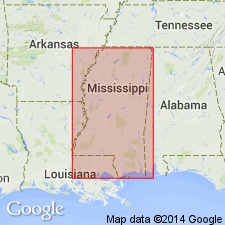
Pine Island Formation is a transgressive sequence primarily consisting of shales with occasional fine-grained sand and siltstone stringers. In West Raymond, the Pine Island is 100 to 150 ft thick and productive in one well. Conformably overlies the Sligo Formation and underlies the Rodessa Formation. Age is Early Cretaceous.
Source: GNU records (USGS DDS-6; Reston GNULEX).
For more information, please contact Nancy Stamm, Geologic Names Committee Secretary.
Asterisk (*) indicates published by U.S. Geological Survey authors.
"No current usage" (†) implies that a name has been abandoned or has fallen into disuse. Former usage and, if known, replacement name given in parentheses ( ).
Slash (/) indicates name conflicts with nomenclatural guidelines (CSN, 1933; ACSN, 1961, 1970; NACSN, 1983, 2005, 2021). May be explained within brackets ([ ]).

