

- Usage in publication:
-
- Pine Hollow Formation*
- Modifications:
-
- Named
- Dominant lithology:
-
- Sandstone
- Mudstone
- Limestone
- AAPG geologic province:
-
- Paradox basin
Summary:
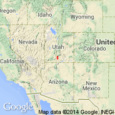
Named for exposures in Pine Hollow, T36S, R1W, Garfield Co, UT in Paradox basin. Type section measured near head of north fork, Pine Hollow, southeast side Table Cliff Plateau approximately in NE1/4 SE1/4 sec 3, T36S, R1W. Is predominantly gray, red and mottled red, argillaceous mudstone, gray, medium- to coarse-grained to conglomeratic, calcareous, lenticular sandstone, and pale purple mottled red, yellow, gray, clastic, silty arenaceous limestone. One mudstone is bentonitic. Is 207 ft thick at type; is thickest (40 ft) near axis of Table Cliff syncline; thins to north or west. Is conformable on, or locally intertongues with, underlying Canaan Peak Formation; is conformable with overlying Wasatch Formation. Thought to have been deposited in a low-energy fluvial and lacustrine environment. Thought to be a post-orogenic deposit. Is barren of fossils. Assigned a Paleocene? age on basis of stratigraphic position above Canaan Peak and below Wasatch.
Source: GNU records (USGS DDS-6; Denver GNULEX).
- Usage in publication:
-
- Pine Hollow Formation
- Modifications:
-
- Age modified
- Overview
- AAPG geologic province:
-
- Paradox basin
Summary:
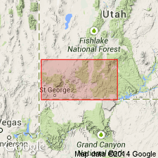
Outcrops along Table Cliff Plateau, central Garfield Co, UT, Paradox basin. Age tentatively regarded as early Paleocene to middle Eocene. Early Paleocene palynomorphs were collected from basal part on southwest side of Table Cliff Plateau (Goldstrand, 1991, unpub. PhD dissert., Univ. Nev., Reno). However, palynomorphs may have been reworked from underlying Canaan Peak Formation. A 50 +/-3 Ma (middle Eocene) fission-track zircon age (B. Kowallis, 1990, written commun.) was obtained from bentonitic mudstone in uppermost part of Pine Hollow on east side of Table Cliff Plateau. Fission-track age is based on a limited number of grains from one location and is considered an approximate age for the upper part of Pine Hollow. Basal part of Pine Hollow where it unconformably overlies Canaan Peak Formation or informal "Grand Castle formation" is commonly conglomeratic and interfingers laterally with red mudstone. Much of this basal conglomerate has been mapped as upper part of Canaan Peak by previous workers. Basal contact is here placed at base of lowest slope-forming, red mudstone or siltstone, or where an angular unconformity occurs between conglomerates of either Canaan Peak or Grand Castle and Pine Hollow. Underlies Claron Formation. Stratigraphic chart.
Source: GNU records (USGS DDS-6; Denver GNULEX).
For more information, please contact Nancy Stamm, Geologic Names Committee Secretary.
Asterisk (*) indicates published by U.S. Geological Survey authors.
"No current usage" (†) implies that a name has been abandoned or has fallen into disuse. Former usage and, if known, replacement name given in parentheses ( ).
Slash (/) indicates name conflicts with nomenclatural guidelines (CSN, 1933; ACSN, 1961, 1970; NACSN, 1983, 2005, 2021). May be explained within brackets ([ ]).