


- Usage in publication:
-
- Pine Hill anhydrite member
- Modifications:
-
- Named
- AAPG geologic province:
-
- Mid-Gulf Coast basin
Summary:
Pine Hill anhydrite member of Late Jurassic Louann Salt first recognized and described in this writing. Named for Pine Hill. Near end of Louann time, Pine Hill anhydrite was deposited in an isolated basin shoreward of the Brevard anticline and Harrigan dome. Described here as white, finely crystalline with random reddish inclusions. Unit varies in thickness up to a maximum of 210 ft. [Though no type section is designated in this report and unit appears to be treated informally, it is accepted as the naming paper by the GNU. See also Oxley and Minihan (1969: Oil and Gas Journal, v. 67, no. 5, p. 125-126.)
Source: GNU records (USGS DDS-6; Reston GNULEX).

- Usage in publication:
-
- Pine Hill Anhydrite Member
- Modifications:
-
- Principal reference
- AAPG geologic province:
-
- Mid-Gulf Coast basin
Summary:
A type well is designated in this report near Pine Hill, in Wilcox County, Alabama. The original reference (Oxley and Minihan) did not contain a type section. [Apparently this unit is treated as formal by the state of Alabama though it has never been formally defined.] It is described here as white finely crystalline anhydrite with random reddish inclusions and occasional interbeds of salt. Locally present at the top of the Louann Salt in the subsurface of southwest Alabama. Thickness reaches a maximum of 100 feet in Washington County. However, where present, thickness generally ranges from 7 to 40 feet. Age is Late Jurassic (Oxfordian?).
Source: GNU records (USGS DDS-6; Reston GNULEX).
- Usage in publication:
-
- Pine Hill Anhydrite Member
- Modifications:
-
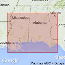
- Areal extent
- AAPG geologic province:
-
- Mid-Gulf Coast basin
Summary:
Stratigraphic column shows Pine Hill present in AL, MS, and the FL panhandle. Underlies Norphlet Formation.
Source: GNU records (USGS DDS-6; Reston GNULEX).
For more information, please contact Nancy Stamm, Geologic Names Committee Secretary.
Asterisk (*) indicates published by U.S. Geological Survey authors.
"No current usage" (†) implies that a name has been abandoned or has fallen into disuse. Former usage and, if known, replacement name given in parentheses ( ).
Slash (/) indicates name conflicts with nomenclatural guidelines (CSN, 1933; ACSN, 1961, 1970; NACSN, 1983, 2005, 2021). May be explained within brackets ([ ]).