The National Geologic Map Database is migrating to a new infrastructure. We apologize for any service disruptions during this process.
|
|---|


- Usage in publication:
-
- Pilot Knob basalt
- Modifications:
-
- First used
- Dominant lithology:
-
- Basalt
- AAPG geologic province:
-
- Ouachita folded belt
Summary:
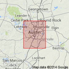
First used as map unit at Pilot Knob, a hill west of the community of Pilot Knob, Travis Co, TX south of Austin, TX in the Ouachita tectonic belt province. Type locality not designated, and derivation of name not given. Intruded rocks of the Austin Group. Is dark-greenish-black to black, microcrystalline basalt that weathers to a brown or rusty color. Is only known to be exposed in the vicinity of Pilot Knob where it makes up the core of Pilot Knob itself and a number of small surrounding hills. [Stratigraphic relations are inconsistently presented. Geologic map explanation (pl. VII) lists the basalt below both the Austin Group and the Pilot Knob tuff. However, Table 7 shows the basalt as a formation at top of Austin Group, above Pilot Knob tuff.] Age is Late Cretaceous.
Source: GNU records (USGS DDS-6; Denver GNULEX).
For more information, please contact Nancy Stamm, Geologic Names Committee Secretary.
Asterisk (*) indicates published by U.S. Geological Survey authors.
"No current usage" (†) implies that a name has been abandoned or has fallen into disuse. Former usage and, if known, replacement name given in parentheses ( ).
Slash (/) indicates name conflicts with nomenclatural guidelines (CSN, 1933; ACSN, 1961, 1970; NACSN, 1983, 2005, 2021). May be explained within brackets ([ ]).