The National Geologic Map Database is migrating to a new infrastructure. We apologize for any service disruptions during this process.
|
|---|


- Usage in publication:
-
- Piermont member
- Modifications:
-
- Original reference
- Dominant lithology:
-
- Schist
- AAPG geologic province:
-
- New England province
Summary:
(J.B. Hadley, 1938, Geologic map and structure sections of the New Hampshire portion of the Mt. Cube quadrangle).
Piermont member of Albee formation. Consists of dark-gray quartz-mica schist, mica schist, staurolite schist and local beds of fine conglomerate, of volcanic origin in part, interbedded with the schists and quartzites of the Albee formation. Age is Late Ordovician(?).
Source: US geologic names lexicon (USGS Bull. 1200, p. 3012-3013).
- Usage in publication:
-
- Piermont member
- Modifications:
-
- Principal reference
- Dominant lithology:
-
- Schist
- AAPG geologic province:
-
- New England province
Summary:
Pg. 117, 119 (fig. 2), 126-127. Piermont member of Albee formation. Maximum thickness estimated 1,000 feet. Occurs about 1,000 feet above base of Albee formation. Type locality cited.
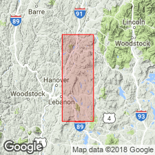
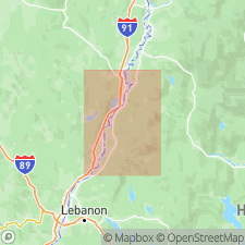
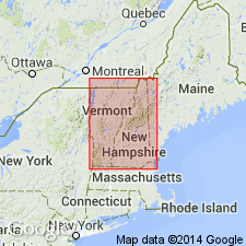
Type locality: Mt. Cube area, in and near village of Piermont, [Mt. Cube 15-min quadrangle], Grafton Co., western NH.
Source: US geologic names lexicon (USGS Bull. 1200, p. 3012-3013).
- Usage in publication:
-
- Piermont member*
- Modifications:
-
- Areal extent
- AAPG geologic province:
-
- New England province
Summary:
Map; M.P. Billings, 1956, Geol. New Hampshire, Pt. 2 Bedrock geol., p. 16. Piermont member of Albee formation. Gray to dark-gray mica schists with porphyoblasts of biotite, garnet, and/or staurolite. Confined to area around Piermont, [Grafton County, New Hampshire]. Lies in staurolite metamorphic zone. Age is Ordovician(?).
Source: Publication; US geologic names lexicon (USGS Bull. 1200, p. 3012-3013).
For more information, please contact Nancy Stamm, Geologic Names Committee Secretary.
Asterisk (*) indicates published by U.S. Geological Survey authors.
"No current usage" (†) implies that a name has been abandoned or has fallen into disuse. Former usage and, if known, replacement name given in parentheses ( ).
Slash (/) indicates name conflicts with nomenclatural guidelines (CSN, 1933; ACSN, 1961, 1970; NACSN, 1983, 2005, 2021). May be explained within brackets ([ ]).