The National Geologic Map Database is migrating to a new infrastructure. We apologize for any service disruptions during this process.
|
|---|


- Usage in publication:
-
- Pictured Cliffs group*
- Pictured Cliffs sandstone*
- Modifications:
-
- Named
- Dominant lithology:
-
- Sandstone
- AAPG geologic province:
-
- San Juan basin
Summary:
Pg. 248, 250, 251, pl. 35. Pictured Cliffs group, also Pictured Cliffs sandstone. Overlies Sand Shale group [later named Lewis shale] and underlies Laramie(?) group. Assigned to Fox Hills epoch. [In pl. 35 is described as consisting, in valley of Rio San Juan, of 130 feet of massive sandstones; on p. 247-248 is described as consisting, between Pinon Mesa and Mesa Verde, of 30 feet of white sandstone followed [downward] by 100 feet of brownish and yellowish sandstones and shales; on p. 251 is described as consisting, as exposed on San Juan down to Great Hogback, of 40 feet of white sandstone and 60 to 80 feet of yellowish-gray sandstone, underlain by 30 to 40 feet of brownish laminated sandstones.]
Named for Pictured Cliffs of San Juan River, northwestern NM.
Source: US geologic names lexicon (USGS Bull. 896, p. 1654-1655).

- Usage in publication:
-
- Pictured Cliffs sandstone*
- Modifications:
-
- Revised
- AAPG geologic province:
-
- San Juan basin
Summary:
Holmes evidently restricted Pictured Cliffs sandstone to the massive ledges and excluded the interbedded shale and sandstones beneath them, which writer believes should be included, and which he does include, making total thickness of formation 281 feet. It grades into underlying Lewis shale and into overlying Fruitland formation, of late Montana age. The Pictured Cliffs sandstone has not been recognized outside of San Juan basin, where it is of variable thickness. It contains a littoral marine fauna of Montana age. [In pl. 4 he correlates it with uppermost part of Pierre shale.]
Source: US geologic names lexicon (USGS Bull. 896, p. 1654-1655).
- Usage in publication:
-
- Pictured Cliffs sandstone*
- Modifications:
-
- Areal extent
- Dominant lithology:
-
- Sandstone
- AAPG geologic province:
-
- San Juan basin
Summary:
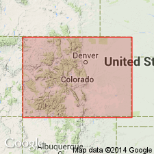
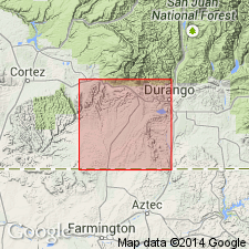
Extends north from New Mexico into La Plata County, Colorado (San Juan basin). Is resistant to erosion; forms hogbacks at some localities. Thickness ranges from 215 to 285 feet. Lower part consists of orange to gray, very fine-grained sandstone interbedded with subordinate amount of gray shale and siltstone. Upper part consists of ledge-forming, medium- to thick-bedded sandstone. Sandstone is ferruginous, calcareous, orange to gray, very fine- to medium-grained, cellular- to cavernous-weathering. Is a beach and nearshore deposit. Overlies Lewis shale; base of Pictured Cliffs placed at lowest horizon where sandstone predominates over shale. Underlies Fruitland formation. Age is Late Cretaceous. Report includes geologic map, columnar section.
Source: Modified from GNU records (USGS DDS-6; Denver GNULEX).
- Usage in publication:
-
- Pictured Cliffs sandstone*
- Modifications:
-
- Areal extent
- AAPG geologic province:
-
- San Juan basin
Summary:
Pg. 2159. Discussion of revised nomenclature of Mesaverde group in San Juan basin and its bearing on problem of nomenclature of Pictured Cliffs and Cliff House sandstones. As result of southward thinning and termination of Lewis shale, Pictured Cliffs and Cliff House sandstones are in direct contact and for several miles southeast of Newcomb form an inseparable unit. It seems advisable, however, to maintain name Pictured Cliffs and its identity as a distinct formation for the following reasons: its long-standing and well-understood usage; it represents closing stages of marine Cretaceous deposition in San Juan basin, and there is some suggestion that part of it may have had a northern source differing from that of underlying Mesaverde; everywhere separated from Mesaverde in subsurface; known intertonguing relations with both Lewis shale and overlying Fruitland formation suggest that there may develop a need for named tongues of Pictured Cliffs. Age is Late Cretaceous. Report includes simplified geologic map, diagrammatic cross section.
Source: US geologic names lexicon (USGS Bull. 1200, p. 3008-3009).
- Usage in publication:
-
- Pictured Cliffs Sandstone*
- Modifications:
-
- Mapped 1:50k
- Dominant lithology:
-
- Sandstone
- Shale
- AAPG geologic province:
-
- San Juan basin
Summary:
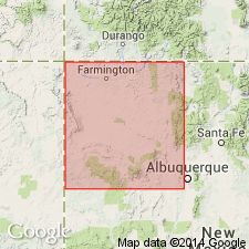
Is Upper Cretaceous formation mapped in San Juan Co, NM (San Juan basin). Overlies Lewis Shale (Upper Cretaceous) with transitional contact; underlies Fruitland Formation (Upper Cretaceous). Is yellowish-gray to grayish-orange, thick-bedded and cross-bedded, cliff-forming, well-sorted, friable, fine-grained sandstone in upper part. Contains brown, hard, round, slabby, calcareous sandstone concretions that are parallel to bedding and as large as 4 ft in diameter. Lower part consists of alternating thin beds of yellowish-gray to moderate-brown, fine-grained to very fine grained sandstone and light-gray to dark-gray, silty shale. Upper 6.5 ft of shaly unit contains thin discontinuous layer of hard fine-grained ironstone. Contains fossil marine invertebrates and casts and impressions of burrows of OPHIOMORPHA MAJOR, which are indicative of nearshore marine environment. Forms low bluffs. Is about 60 ft thick.
Source: GNU records (USGS DDS-6; Denver GNULEX).
- Usage in publication:
-
- Pictured Cliffs Sandstone*
- Modifications:
-
- Areal extent
- AAPG geologic province:
-
- San Juan basin
Summary:
Mapped on five cross sections in the subsurface of southern La Plata County, Colorado (San Juan basin). Lower contact with Upper Cretaceous Lewis Shale is intertonguing. Upper contact with Upper Cretaceous Fruitland Formation is intertonguing. Age is Late Cretaceous.
Source: GNU records (USGS DDS-6; Denver GNULEX).
For more information, please contact Nancy Stamm, Geologic Names Committee Secretary.
Asterisk (*) indicates published by U.S. Geological Survey authors.
"No current usage" (†) implies that a name has been abandoned or has fallen into disuse. Former usage and, if known, replacement name given in parentheses ( ).
Slash (/) indicates name conflicts with nomenclatural guidelines (CSN, 1933; ACSN, 1961, 1970; NACSN, 1983, 2005, 2021). May be explained within brackets ([ ]).