- Usage in publication:
-
- Picayune Valley Formation*
- Modifications:
-
- Named
- Reference
- Dominant lithology:
-
- Quartzite
- Conglomerate
- AAPG geologic province:
-
- Sierra Nevada province
Summary:
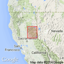
Named for Picayune Valley where open glaciated exposures at NE/4 sec.8 T15N R15E, Granite Chief 7.5' quad [Placer Co, CA] are designated type locality. Reference section designated at 5640- and 5840-ft contours above Talbot Campground (center sec.1 T15N R14E, Granite Chief 7.5' quad). Is oldest unit in Lake Tahoe sequence. Primarily composed of interbedded quartzite and black pelite that contain scattered thin lenses of chert-rich conglomerate. Depositional thickness unknown but probably less than 600 m. East of Talbot Campground and in Five Lakes Creek disconformably overlies Shoo Fly Complex; in North Fork of American River drainage gradationally underlies Serena Creek Formation (new). In fault or unconformable contact with underlying Blackwood Creek Formation (new) in Rubican River. Age is considered as Late Devonian and Early Mississippian based on fossils (echinoderm fragments) and stratigraphic correlation.
Source: GNU records (USGS DDS-6; Menlo GNULEX).
For more information, please contact Nancy Stamm, Geologic Names Committee Secretary.
Asterisk (*) indicates published by U.S. Geological Survey authors.
"No current usage" (†) implies that a name has been abandoned or has fallen into disuse. Former usage and, if known, replacement name given in parentheses ( ).
Slash (/) indicates name conflicts with nomenclatural guidelines (CSN, 1933; ACSN, 1961, 1970; NACSN, 1983, 2005, 2021). May be explained within brackets ([ ]).

