The National Geologic Map Database is migrating to a new infrastructure. We apologize for any service disruptions during this process.
|
|---|


- Usage in publication:
-
- Pfeifer shale member*
- Modifications:
-
- Named
- Dominant lithology:
-
- Limestone
- Shale
- AAPG geologic province:
-
- Central Kansas uplift
Summary:
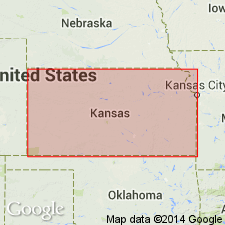
Named as uppermost of four members of Greenhorn limestone for exposures near Pfeifer, Ellis Co, KS, Central Kansas uplift. No type locality designated. Section measured in roadcut in SE1/4 sec 21, T15S, R17W. Is 19-21 ft thick and consists of alternating layers of chalky shale and chalky limestone, the latter in beds from 3-8 in thick. On fresh exposure the entire mass presents a blue color, but on weathering it becomes a light tan or cream. In general the member produces gently graded slopes, the topmost bed forming a slight shoulder. Its outcrop throughout this region is commonly marked by white mounds of overburden removed in quarrying the "fence-post" limestone bed (which is topmost, capping unit of Pfeifer, so called because it is extensively quarried and used for fence posts throughout outcrop region). Underlies Fairport chalky shale member of Carlile shale; overlies Jetmore chalk member of Greenhorn. Nearly 150 mi southwest of Ellis Co where the Greenhorn is exposed along the Arkansas valley in Kearny and Hamilton Cos, Anadarko basin, the four divisions of Greenhorn can be recognized, but upper two are less easily distinguishable. There the entire formation has a thickness of 130 ft; the upper 74 ft is made up of beds corresponding to Pfeifer shale and Jetmore chalk members--these beds are here named Bridge Creek limestone member of Greenhorn. Pfeifer is of Late Cretaceous age. Stratigraphic chart.
Source: GNU records (USGS DDS-6; Denver GNULEX).
For more information, please contact Nancy Stamm, Geologic Names Committee Secretary.
Asterisk (*) indicates published by U.S. Geological Survey authors.
"No current usage" (†) implies that a name has been abandoned or has fallen into disuse. Former usage and, if known, replacement name given in parentheses ( ).
Slash (/) indicates name conflicts with nomenclatural guidelines (CSN, 1933; ACSN, 1961, 1970; NACSN, 1983, 2005, 2021). May be explained within brackets ([ ]).