- Usage in publication:
-
- Pettus Lake Member
- Modifications:
-
- Named
- Biostratigraphic dating
- AAPG geologic province:
-
- Great Basin province
Summary:
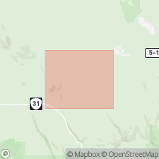
Unit is named the Pettus Lake Member of the Fort Rock Formation. Is exposed in the Fort Rock basin, south-central OR. Includes the diatomite-dominated rocks of the informal tuffaceous sandstone and siltstone, tuff, and diatomite unit Tst, mapped by Walker and others (1967); the remainder of unit Tst is grouped with their palagonitic tuff unit QTps, here referred to informally as the volcaniclastic rocks of Seven Mile Ridge and Table Rock. Consists of white, pale-orange, or pale-gray, thick-bedded diatomite containing irregularly spaced tabular interbeds of volcanic ash and pumice. Overlies the Picture Rock Basalt; conformably underlies and is interbedded with the volcaniclastic breccia of Seven Mile Ridge. Thickness is about 4 m at the type section and about 91 m in the central part of the Fort Rock basin. Age is early Pliocene based on fossils [diatoms]. (B1565)
Source: GNU records (USGS DDS-6; Menlo GNULEX).
For more information, please contact Nancy Stamm, Geologic Names Committee Secretary.
Asterisk (*) indicates published by U.S. Geological Survey authors.
"No current usage" (†) implies that a name has been abandoned or has fallen into disuse. Former usage and, if known, replacement name given in parentheses ( ).
Slash (/) indicates name conflicts with nomenclatural guidelines (CSN, 1933; ACSN, 1961, 1970; NACSN, 1983, 2005, 2021). May be explained within brackets ([ ]).

