


- Usage in publication:
-
- Perote member*
- Modifications:
-
- Original reference
- Dominant lithology:
-
- Sand
- Silt
- AAPG geologic province:
-
- Mid-Gulf Coast basin
Summary:
Pg. 44, 51-53; 1950, USGS Oil and Gas Inv. Prelim. Map 105; 1955 USGS Bull. 1014, p. 70, 71 (fig. 11), 72. Perote member of Providence sand. Consists chiefly of fine sand and silt which is carbonaceous and highly micaceous. Conformable with a coarser unnamed upper member. At type locality, approximately 150 feet thick and constitutes about half of entire Providence section. Overlies Ripley formation. Merges westward into Prairie Bluff chalk. Thins eastward, and at type locality of Providence (in western Georgia), member is about 40 feet thick. Age is Late Cretaceous.
Type locality: along U.S. Highway 29 in vicinity of village of Perote, southern Bullock Co., eastern AL.
Source: US geologic names lexicon (USGS Bull. 1200, p. 2989).
- Usage in publication:
-
- Perote Member
- Modifications:
-
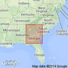
- Areal extent
- AAPG geologic province:
-
- South Georgia sedimentary province
Summary:
Perote Member of Providence Sand mapped in GA as State usage. Age is Gulfian.
Source: GNU records (USGS DDS-6; Reston GNULEX).

- Usage in publication:
-
- Perote
- Modifications:
-
- Not used
- AAPG geologic province:
-
- Mid-Gulf Coast basin
Summary:
Perote not listed in this compilation. Providence Sand of Selma Group is informally divided into upper and lower unnamed parts.
Source: GNU records (USGS DDS-6; Reston GNULEX).
For more information, please contact Nancy Stamm, Geologic Names Committee Secretary.
Asterisk (*) indicates published by U.S. Geological Survey authors.
"No current usage" (†) implies that a name has been abandoned or has fallen into disuse. Former usage and, if known, replacement name given in parentheses ( ).
Slash (/) indicates name conflicts with nomenclatural guidelines (CSN, 1933; ACSN, 1961, 1970; NACSN, 1983, 2005, 2021). May be explained within brackets ([ ]).