The National Geologic Map Database is migrating to a new infrastructure. We apologize for any service disruptions during this process.
|
|---|


- Usage in publication:
-
- Perdido formation*
- Modifications:
-
- Original reference
- Dominant lithology:
-
- Siltstone
- Shale
- Limestone
- Chert
- Conglomerate
- AAPG geologic province:
-
- Great Basin province
Summary:
p. 3, 14 (fig. 6), 22-25, pls. 1, 2, 3. Perdido formation. Consists of siltstone, shale, limestone, chert, and conglomerate; pale red to dark gray weathering reddish brown, brown, or gray; siltstone predominant in upper part, limestone predominant in lower part, characterized also by bedded chert. Lithology is greatly diversified within one section and also from place to place so that heterogeneity is an outstanding characteristic. Thickness about 610 feet at type locality; 220 feet in canyon below Ubehebe Mine, west of Quartz Spring area. Underlies Pennsylvanian(?) Rest Spring shale (new); overlies Tin Mountain limestone (new). Age is Mississippian.
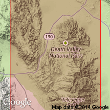
Type locality: extending south from Perdido Canyon, Inyo Co., eastern CA. In the canyon, a fault between Perdido and Rest Springs formations cuts out uppermost part of Perdido, but this segment is well exposed south of Rest Spring. Type locality is supplemented by a second locality, about 3,000 ft south of Rest Spring.
Named from Perdido Canyon, where formation is exposed from foot of southern wall, about 9,000 feet southeast of Quartz Spring, over hill to underlying Tin Mountain limestone.
Source: US geologic names lexicon (USGS Bull. 1200, p. 2987).
- Usage in publication:
-
- Perdido formation
- Modifications:
-
- Areal extent
- AAPG geologic province:
-
- Great Basin province
Summary:
Pg. 97-99, 137-140. Perdido formation. In Quartz Spring area, [northern Panamint Range], Inyo County, eastern California, consists of a lower limestone member and an upper siltstone member. Thickness about 424 feet (section incomplete). Overlies Tin Mountain formation. Age is Late Mississippian.
Source: US geologic names lexicon (USGS Bull. 1200, p. 2987).
- Usage in publication:
-
- Perdido Group*
- Modifications:
-
- Revised
- Biostratigraphic dating
- AAPG geologic province:
-
- Great Basin province
Summary:
Perdido Group. The Perdido Formation of McAllister (1952) is raised to group rank and divided into (descending) Mexican Spring Formation, 97 m thick, and Leaning Rock Formation, 83 m thick (both new). Total thickness of group 180 m. Underlies Rest Spring Shale; the upper contact of McAllister's Perdido is lowered by about 3 m to exclude the dark-gray, very fine-grained, ammonoid-bearing, argillaceous limestone (transferred to the Rest Spring), thus top of Perdido now placed at top of highest siltstone, sandstone, or limestone turbidite bed below this bed which is regionally recognizable. Overlies Tin Mountain Limestone. Age is late Early to early Late Mississippian (Osagean to Meramecian; Lower TYPICUS to Lower CAVUSGNATUS conodont zone of Poole and Sandberg, 1991; Mamet foraminiferal zones 7-15).
Geographically restricted to central-facies belt (an upward-deepening sequence of beds deposited mostly in slope and basinal environments) of eastern Inyo County, eastern California, notably the Quartz Spring, western Cottonwood Mountains area; rocks previously identified as Perdido elsewhere are now included in Kearsarge Formation and Stone Canyon Formation. (See also entries under Kearsarge and Stone Canyon.)
Source: Publication.
For more information, please contact Nancy Stamm, Geologic Names Committee Secretary.
Asterisk (*) indicates published by U.S. Geological Survey authors.
"No current usage" (†) implies that a name has been abandoned or has fallen into disuse. Former usage and, if known, replacement name given in parentheses ( ).
Slash (/) indicates name conflicts with nomenclatural guidelines (CSN, 1933; ACSN, 1961, 1970; NACSN, 1983, 2005, 2021). May be explained within brackets ([ ]).