The National Geologic Map Database is migrating to a new infrastructure. We apologize for any service disruptions during this process.
|
|---|


- Usage in publication:
-
- Pequop formation
- Modifications:
-
- Contact revised
- AAPG geologic province:
-
- Great Basin province
Summary:
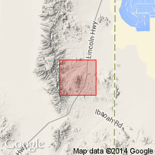
Lower contact revised in that Pequop overlies the newly named Ferguson Mountain Formation. This new name replaces Ferguson Spring Formation which was named (Steele, 1959) in an unpublished thesis. Basal unit of Pequop is a orange to brown calcareous siltstone 498 ft thick. Pequop total thickness is 681.5 ft. Mapped (geologic map) on west side of Ferguson Mountains in T30N, R69E, Elko Co., NV in the Great Basin province. Nomenclature charts. Consists of gray (gray-brown weathering) interbedded bioclastic limestone and calcareous, aphanitic to fine grained quartzite, deposits of a regressive sea on a stable shelf. Fusulinids listed. Of late Wolfcampian and Leonardian, Permian age.
Source: GNU records (USGS DDS-6; Denver GNULEX).
- Usage in publication:
-
- Pequop formation
- Modifications:
-
- Named
- Dominant lithology:
-
- Limestone
- Anhydrite
- Gypsum
- Sandstone
- Siltstone
- AAPG geologic province:
-
- Great Basin province
Summary:
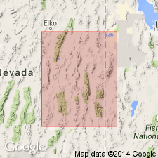
Pg. 93 (chart 1), 106. (Road logs dated Sept. 8-10.) Formal proposal of name. Included in the Carbon Ridge herein raised to group status. Divided into (ascending): Lower Moorman Ranch member, Summit Springs evaporite member (new) [subsurface only?], and Upper Moorman Ranch member. Lower and Upper Moorman Ranch members described as thick sequence of fusulinid-bearing, purple-gray, irregularly bedded, platy limestone and interbedded yellow-orange, fine-grained sandstone and siltstone. Outcrops distributed over area of 18,000 sq. mi. in Elko, central White Pine, northern Nye, and eastern Eureka Counties, Nevada, and western Box Elder and Tooele Counties, Utah (Great Basin province); see areal extent map. Thickness 1,570 feet at type locality. Overlies Ferguson Springs formation (new) and in some areas Riepetown sandstone (new); underlies Loray formation (new). Age is Permian (early Leonardian to early Guadalupian), based on prolific fusulinid fauna. Colonial corals present in lower part. Report includes correlation chart.
Type section: in sec. 3, T. 33 N., R. 65 E., Elko Co., NV. Section measured 1.5 mi north of Jasper railroad tunnel in central part of Pequop Mountains.
[Lower Moorman Ranch member and Upper Moorman Ranch member not adopted by the USGS as formal members; nomenclature guidelines state the use of identical geographic names to several minor stratigraphic units in one vertical sequence is considered informal nomenclature (CSN, 1933; ACSN, 1961, 1970; NACSN, 1983, 2005, 2021).]
Source: US geologic names lexicon (USGS Bull. 1200, p. 2985-2986); supplemental information from GNU records (USGS DDS-6; Denver GNULEX).
- Usage in publication:
-
- Pequop Formation
- Modifications:
-
- Revised
- AAPG geologic province:
-
- Great Basin province
Summary:
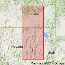
Revised in that Pequop assigned to Arcturus Group (rank raised). Overlies Riepetown Formation of Arcturus and underlies Loray Formation, upper formation of Arcturus. In areas where the lower part of the Arcturus cannot be divided, Pequop rests on the Ferguson Mountain Formation of Arcturus. Divisible into 3 [?] members --"Lower Moorman Ranch Member," Summit Springs Member, and "Upper Moorman Ranch Member" [use of lower and upper as applied to the Moorman Ranch was considered informal in the 1961 Code of Stratigraphic Nomenclature, art l0h, the code to be followed in 1964; "Two names should not be derived from the same geographic name" NASC, 1983, art. 7a.]. Term Pequop used across the report area from eastern NV into western UT in the Great Basin province. Correlation chart. Cross sections. Of Leonardian, [Early] Permian age. Detailed history of usage of Pequop. Nomenclature chart. Cross sections. Graphic section.
Source: GNU records (USGS DDS-6; Denver GNULEX).
For more information, please contact Nancy Stamm, Geologic Names Committee Secretary.
Asterisk (*) indicates published by U.S. Geological Survey authors.
"No current usage" (†) implies that a name has been abandoned or has fallen into disuse. Former usage and, if known, replacement name given in parentheses ( ).
Slash (/) indicates name conflicts with nomenclatural guidelines (CSN, 1933; ACSN, 1961, 1970; NACSN, 1983, 2005, 2021). May be explained within brackets ([ ]).